Caimanero geodata
Caimanero (Sinaloa) is a populated place; located in Mexico in America/Mazatlan (GMT-7) time zone. With population of 1,500 people, there are 5753 cities with bigger population in this country. Compared to other cities in Mexico, 93.1% of cities are located further ↓South; 96.2% of cities are located further →East and 90.8% of cities have higher elevation than Caimanero. Note1


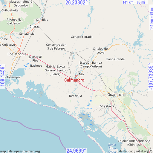
Caimanero GPS coordinates[2]
25° 36' 20.304" North, 108° 26' 32.892" West
| Map corner | latitude | longitude |
|---|---|---|
| Upper-left | 26.23802°, | -109.1456° |
| Center: | 25.60564°, | -108.44247° |
| Lower-right: | 24.9699°, | -107.73935° |
| Map W x H: | 141×141 km | = 87.6×87.6mi |
| max Lat: | 32.7° ⇑6.9% North |
| Caimanero: | 25.60564° |
| min Lat: | ⇓93.1% South 14.53588° |
| min Long | Caimanero | max Long |
| -117.105° | -108.44247° | -86.73105° |
| W 3.8%⇐ | ⇒96.2% E |
Elevation
Elevation of Caimanero is 22 m = 72 ft, and this is 1231.7 m = 4041 ft below average elevation for this country.
| Max E: |
3497 m = 11473 ft | 90.8% |
| Avg. | 1253.7 m = 4113 ft | |
| Caimanero | 22 m = 72 ft | |
Min E: |
-1 m = -3 ft | 9.2% |
See also: Mexico elevation on elevation.city.
Geographical zone
Caimanero is located in North temperate zone (between Tropic of Cancer and the Arctic Circle). Distance of this Northern Tropic circle is 241.2 km =149.9 mi to South.| Distance of | km | miles | from Caimanero |
|---|---|---|---|
| North Pole | 7160 | 4449 | to North |
| Arctic Circle | 4554.1 | 2829.8 | to North |
| Tropic Cancer | 241.2 | 149.9 | to South |
| Equator | 2847.1 | 1769.1 | to South |


Nearby cities:
15 places around Caimanero: (largest is in red/bold)
• El Cuitabón
1.8 km =1.1 mi,  29°
29°
• El Nio
4.7 km =2.9 mi,  63°
63°
• El Varal (San Sebastián Número Uno)
4.5 km =2.8 mi,  22°
22°
• Gambino
7.6 km =4.7 mi,  47°
47°
• Guasave
4.9 km =3 mi,  210°
210°
• Guasavito
5.9 km =3.7 mi,  172°
172°
• La Escalera
4.2 km =2.6 mi,  315°
315°
• Ladrilleras de Ocoro
1.1 km =0.7 mi,  219°
219°
• Las Crucecitas
2.8 km =1.7 mi, 170°
• Las Moras
6 km =3.7 mi,  344°
344°
• Los Angeles
3.9 km =2.4 mi,  265°
265°
• Pueblo Viejo
2.8 km =1.7 mi,  70°
70°
• Ranchito de Castro
3.2 km =2 mi,  129°
129°
• Ranchito de Inzunza
5 km =3.1 mi,  329°
329°
• San Pedro Guasave
7.6 km =4.7 mi,  190°
190°
Sources, notices
• [Note1] Compared only with cities in Mexico existing in our database
• [Src1] Map data: © OpenStreetMap contributors (CC-BY-SA)
• [Src2] Other city data from geonames.org with taken over terms of usage.
• [Src3] Geographical zone / Annual Mean Temperature by Robert A. Rohde @ Wikipedia
