San Miguel Cuyutlán geodata
San Miguel Cuyutlán (Jalisco) is a populated place; located in Mexico in America/Mexico_City (GMT-6) time zone. With population of 7,533 people, there are 1240 cities with bigger population in this country. Compared to other cities in Mexico, 66% of cities are located further ↓South; 87.7% of cities are located further →East and 54.9% of cities have lower elevation than San Miguel Cuyutlán. Note1


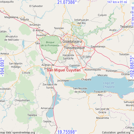
San Miguel Cuyutlán GPS coordinates[2]
20° 24' 58.788" North, 103° 23' 23.532" West
| Map corner | latitude | longitude |
|---|---|---|
| Upper-left | 21.07386°, | -104.093° |
| Center: | 20.41633°, | -103.38987° |
| Lower-right: | 19.75598°, | -102.68675° |
| Map W x H: | 146.5×146.5 km | = 91×91mi |
| max Lat: | 32.7° ⇑34% North |
| San Miguel Cuyutlán: | 20.41633° |
| min Lat: | ⇓66% South 14.53588° |
| min Long | San Miguel Cuyu | max Long |
| -117.105° | -103.38987° | -86.73105° |
| W 12.3%⇐ | ⇒87.7% E |
Elevation
Elevation of San Miguel Cuyutlán is 1585 m = 5200 ft, and this is 331.3 m = 1087 ft above average elevation for this country.
| Max E: |
3497 m = 11473 ft | 45.1% |
| San Miguel Cuyutlán | 1585 m 5200 ft | |
| Avg. | 1253.7 m = 4113 ft | |
Min E: |
-1 m = -3 ft | 54.9% |
See also: Mexico elevation on elevation.city.
Geographical zone
San Miguel Cuyutlán is located in North Torrid zone (between Equator and Tropic of Cancer). Distance of this Northern Tropic circle is 335.8 km =208.7 mi to North.| Distance of | km | miles | from San Miguel Cuyutlán |
|---|---|---|---|
| North Pole | 7737 | 4807.5 | to North |
| Arctic Circle | 5131.1 | 3188.3 | to North |
| Tropic Cancer | 335.8 | 208.7 | to North |
| Equator | 2270.1 | 1410.6 | to South |


Nearby cities:
15 places around San Miguel Cuyutlán: (largest is in red/bold)
• Cajititlán
8.6 km =5.3 mi,  78°
78°
• Cima del Sol (Fraccionamiento Cima del Sol)
6.5 km =4 mi,  334°
334°
• Colinas del Roble
9.8 km =6.1 mi,  354°
354°
• Cuexcomatitlán
3.2 km =2 mi,  65°
65°
• El Cortijo
6.8 km =4.2 mi, 330°
• Galaxia la Noria
5.5 km =3.4 mi, 326°
• Hacienda Santa Fe
11.4 km =7.1 mi,  4°
4°
• La Fortuna [Fraccionamiento]
7.6 km =4.7 mi,  355°
355°
• La Roca
11.4 km =7.1 mi,  340°
340°
• Las Trojes
11.1 km =6.9 mi,  145°
145°
• Lomas de Tejeda
5.7 km =3.5 mi, 347°
• Lomas del Sur
8.9 km =5.5 mi, 341°
• Potrerillos
8.8 km =5.5 mi,  171°
171°
• San Lucas Evangelista
3.2 km =2 mi,  106°
106°
• Tlajomulco de Zúñiga
8.7 km =5.4 mi,  317°
317°
Sources, notices
• [Note1] Compared only with cities in Mexico existing in our database
• [Src1] Map data: © OpenStreetMap contributors (CC-BY-SA)
• [Src2] Other city data from geonames.org with taken over terms of usage.
• [Src3] Geographical zone / Annual Mean Temperature by Robert A. Rohde @ Wikipedia
