Villa de Costa Rica geodata
Villa de Costa Rica (Sinaloa) is a populated place; located in Mexico in America/Mazatlan (GMT-7) time zone. With population of 24,874 people, there are 410 cities with bigger population in this country. Compared to other cities in Mexico, 91% of cities are located further ↓South; 94.8% of cities are located further →East and 87.7% of cities have higher elevation than Villa de Costa Rica. Note1


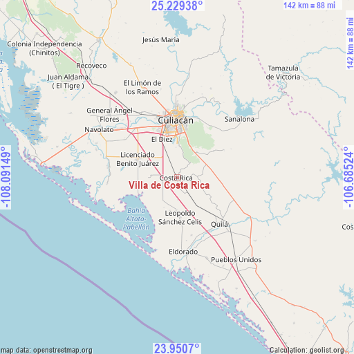
Villa de Costa Rica GPS coordinates[2]
24° 35' 30.012" North, 107° 23' 18.096" West
| Map corner | latitude | longitude |
|---|---|---|
| Upper-left | 25.22938°, | -108.09149° |
| Center: | 24.59167°, | -107.38836° |
| Lower-right: | 23.9507°, | -106.68524° |
| Map W x H: | 142.2×142.2 km | = 88.4×88.4mi |
| max Lat: | 32.7° ⇑9% North |
| Villa de Costa Rica: | 24.59167° |
| min Lat: | ⇓91% South 14.53588° |
| min Long | Villa de Costa | max Long |
| -117.105° | -107.38836° | -86.73105° |
| W 5.2%⇐ | ⇒94.8% E |
Elevation
Elevation of Villa de Costa Rica is 31 m = 102 ft, and this is 1222.7 m = 4011 ft below average elevation for this country.
| Max E: |
3497 m = 11473 ft | 87.7% |
| Avg. | 1253.7 m = 4113 ft | |
| Villa de Costa Rica | 31 m = 102 ft | |
Min E: |
-1 m = -3 ft | 12.3% |
See also: Mexico elevation on elevation.city.
Geographical zone
Villa de Costa Rica is located in North temperate zone (between Tropic of Cancer and the Arctic Circle). Distance of this Northern Tropic circle is 128.4 km =79.8 mi to South.| Distance of | km | miles | from Villa de Costa Rica |
|---|---|---|---|
| North Pole | 7272.7 | 4519 | to North |
| Arctic Circle | 4666.8 | 2899.8 | to North |
| Tropic Cancer | 128.4 | 79.8 | to South |
| Equator | 2734.3 | 1699 | to South |


Nearby cities:
15 places around Villa de Costa Rica: (largest is in red/bold)
• Argentina Dos
14.6 km =9.1 mi,  343°
343°
• Bachigualatito
15.8 km =9.8 mi,  328°
328°
• Ejido Mezquitillo (Chapeteado)
13.3 km =8.3 mi,  203°
203°
• Ejido Mezquitillo (La Curva)
13 km =8.1 mi,  179°
179°
• Ejido Mezquitillo Número Dos
9.1 km =5.7 mi, 178°
• Ejido Tierra y Libertad Número Dos
13.2 km =8.2 mi,  144°
144°
• Ejido el Quemadito
12.1 km =7.5 mi,  347°
347°
• Ejido la Arrocera
14.2 km =8.8 mi, 178°
• El Diez
16 km =9.9 mi, 336°
• Laguna Colorada
12.7 km =7.9 mi,  38°
38°
• Las Puentes (Guadalupe Victoria)
16.7 km =10.4 mi,  246°
246°
• Miguel Valdez Quintero (El Corazón)
13 km =8.1 mi,  146°
146°
• Nuevo Centro de Población Ejidal el 30
2 km =1.2 mi,  357°
357°
• Pueblo Nuevo
3.6 km =2.2 mi,  87°
87°
• Valle Escondido
15.6 km =9.7 mi,  120°
120°
Sources, notices
• [Note1] Compared only with cities in Mexico existing in our database
• [Src1] Map data: © OpenStreetMap contributors (CC-BY-SA)
• [Src2] Other city data from geonames.org with taken over terms of usage.
• [Src3] Geographical zone / Annual Mean Temperature by Robert A. Rohde @ Wikipedia
