Compuertas geodata
Compuertas (Coahuila) is a populated place; located in Mexico in America/Monterrey (GMT-6) time zone. With population of 1,017 people, there are 8563 cities with bigger population in this country. Compared to other cities in Mexico, 94% of cities are located further ↓South; 87.2% of cities are located further →East and 57.5% of cities have higher elevation than Compuertas. Note1


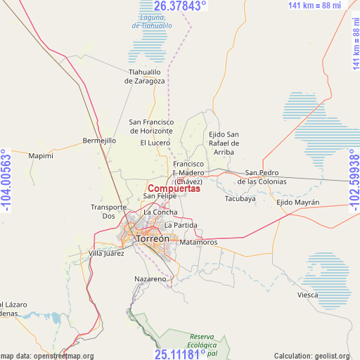
Compuertas GPS coordinates[2]
25° 44' 48.516" North, 103° 18' 9" West
| Map corner | latitude | longitude |
|---|---|---|
| Upper-left | 26.37843°, | -104.00563° |
| Center: | 25.74681°, | -103.3025° |
| Lower-right: | 25.11181°, | -102.59938° |
| Map W x H: | 140.8×140.8 km | = 87.5×87.5mi |
| max Lat: | 32.7° ⇑6% North |
| Compuertas: | 25.74681° |
| min Lat: | ⇓94% South 14.53588° |
| min Long | Compuertas | max Long |
| -117.105° | -103.3025° | -86.73105° |
| W 12.8%⇐ | ⇒87.2% E |
Elevation
Elevation of Compuertas is 1114 m = 3655 ft, and this is 139.7 m = 458 ft below average elevation for this country.
| Max E: |
3497 m = 11473 ft | 57.5% |
| Avg. | 1253.7 m = 4113 ft | |
| Compuertas | 1114 m = 3655 ft | |
Min E: |
-1 m = -3 ft | 42.5% |
See also: Mexico elevation on elevation.city.
Geographical zone
Compuertas is located in North temperate zone (between Tropic of Cancer and the Arctic Circle). Distance of this Northern Tropic circle is 256.9 km =159.6 mi to South.| Distance of | km | miles | from Compuertas |
|---|---|---|---|
| North Pole | 7144.3 | 4439.3 | to North |
| Arctic Circle | 4538.4 | 2820 | to North |
| Tropic Cancer | 256.9 | 159.6 | to South |
| Equator | 2862.8 | 1778.9 | to South |


Nearby cities:
15 places around Compuertas: (largest is in red/bold)
• Alamito
2.6 km =1.6 mi,  184°
184°
• Coyote
6 km =3.7 mi,  162°
162°
• El Pilar
5.8 km =3.6 mi,  236°
236°
• El Porvenir (El Porvenir de Arriba)
3.8 km =2.4 mi,  323°
323°
• Francisco I. Madero
4.3 km =2.7 mi,  47°
47°
• Jaboncillo
3.7 km =2.3 mi,  87°
87°
• La Florida
3.2 km =2 mi, 317°
• Nuevo León
3.2 km =2 mi,  166°
166°
• San Antonio del Coyote
6.1 km =3.8 mi, 163°
• San Esteban de Egipto
3.2 km =2 mi,  256°
256°
• Santa Ana del Pilar
4.2 km =2.6 mi,  188°
188°
• Santa Cruz Luján
6.1 km =3.8 mi,  246°
246°
• Veinte de Noviembre
4.7 km =2.9 mi,  214°
214°
• Venecia
6.1 km =3.8 mi,  304°
304°
• Villa Gregorio García
5 km =3.1 mi,  276°
276°
Sources, notices
• [Note1] Compared only with cities in Mexico existing in our database
• [Src1] Map data: © OpenStreetMap contributors (CC-BY-SA)
• [Src2] Other city data from geonames.org with taken over terms of usage.
• [Src3] Geographical zone / Annual Mean Temperature by Robert A. Rohde @ Wikipedia
