Ceuta geodata
Ceuta (Sinaloa) is a populated place; located in Mexico in America/Mazatlan (GMT-7) time zone. With population of 1,208 people, there are 7203 cities with bigger population in this country. Compared to other cities in Mexico, 89.7% of cities are located further ↓South; 94.4% of cities are located further →East and 98.1% of cities have higher elevation than Ceuta. Note1


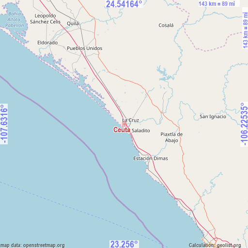
Ceuta GPS coordinates[2]
23° 54' 1.512" North, 106° 55' 42.492" West
| Map corner | latitude | longitude |
|---|---|---|
| Upper-left | 24.54164°, | -107.6316° |
| Center: | 23.90042°, | -106.92847° |
| Lower-right: | 23.256°, | -106.22535° |
| Map W x H: | 142.9×143 km | = 88.8×88.9mi |
| max Lat: | 32.7° ⇑10.3% North |
| Ceuta: | 23.90042° |
| min Lat: | ⇓89.7% South 14.53588° |
| min Long | Ceuta | max Long |
| -117.105° | -106.92847° | -86.73105° |
| W 5.6%⇐ | ⇒94.4% E |
Elevation
Elevation of Ceuta is 8 m = 26 ft, and this is 1245.7 m = 4087 ft below average elevation for this country.
| Max E: |
3497 m = 11473 ft | 98.1% |
| Avg. | 1253.7 m = 4113 ft | |
| Ceuta | 8 m = 26 ft | |
Min E: |
-1 m = -3 ft | 1.9% |
See also: Mexico elevation on elevation.city.
Geographical zone
Ceuta is located in North temperate zone (between Tropic of Cancer and the Arctic Circle). Distance of this Northern Tropic circle is 51.6 km =32.1 mi to South.| Distance of | km | miles | from Ceuta |
|---|---|---|---|
| North Pole | 7349.6 | 4566.8 | to North |
| Arctic Circle | 4743.7 | 2947.6 | to North |
| Tropic Cancer | 51.6 | 32.1 | to South |
| Equator | 2657.5 | 1651.3 | to South |


Nearby cities:
15 places around Ceuta: (largest is in red/bold)
• Boscoso
15.5 km =9.6 mi,  336°
336°
• Casas Viejas
19.5 km =12.1 mi,  38°
38°
• Celestino Gazca Villaseñor
10.3 km =6.4 mi,  151°
151°
• Ejido Culiacán (Culiacancito)
15.3 km =9.5 mi,  318°
318°
• El Bolillo
17.2 km =10.7 mi, 39°
• El Carrizo
14.8 km =9.2 mi,  31°
31°
• El Roble
11.5 km =7.1 mi,  76°
76°
• El Saladito
8.9 km =5.5 mi,  112°
112°
• El Salado
9.3 km =5.8 mi,  90°
90°
• Emiliano Zapata
18 km =11.2 mi,  1°
1°
• Empaque Tarriba
0.3 km =0.2 mi,  266°
266°
• La Cruz
4.3 km =2.7 mi,  57°
57°
• Potrerillo del Norote
14.2 km =8.8 mi, 341°
• Pueblo Nuevo
10.5 km =6.5 mi, 344°
• Tayoltita
7.7 km =4.8 mi,  123°
123°
Sources, notices
• [Note1] Compared only with cities in Mexico existing in our database
• [Src1] Map data: © OpenStreetMap contributors (CC-BY-SA)
• [Src2] Other city data from geonames.org with taken over terms of usage.
• [Src3] Geographical zone / Annual Mean Temperature by Robert A. Rohde @ Wikipedia
