La Laguna Seca geodata
La Laguna Seca (Guanajuato) is a populated place; located in Mexico in America/Mexico_City (GMT-6) time zone. With population of 878 people, there are 9946 cities with bigger population in this country. Compared to other cities in Mexico, 79.7% of cities are located further ↓South; 70.7% of cities are located further →East and 73.2% of cities have lower elevation than La Laguna Seca. Note1


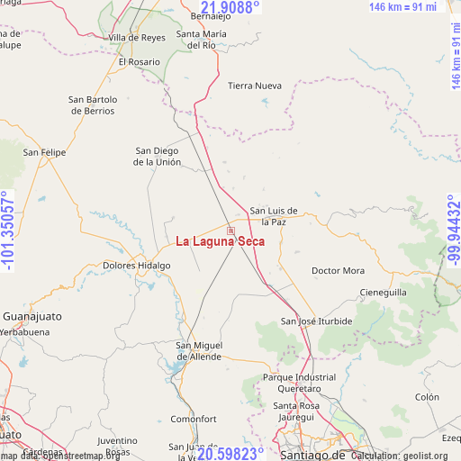
La Laguna Seca GPS coordinates[2]
21° 15' 17.892" North, 100° 38' 50.784" West
| Map corner | latitude | longitude |
|---|---|---|
| Upper-left | 21.9088°, | -101.35057° |
| Center: | 21.25497°, | -100.64744° |
| Lower-right: | 20.59823°, | -99.94432° |
| Map W x H: | 145.7×145.7 km | = 90.5×90.5mi |
| max Lat: | 32.7° ⇑20.3% North |
| La Laguna Seca: | 21.25497° |
| min Lat: | ⇓79.7% South 14.53588° |
| min Long | La Laguna Seca | max Long |
| -117.105° | -100.64744° | -86.73105° |
| W 29.3%⇐ | ⇒70.7% E |
Elevation
Elevation of La Laguna Seca is 1994 m = 6542 ft, and this is 740.3 m = 2429 ft above average elevation for this country.
| Max E: |
3497 m = 11473 ft | 26.8% |
| La Laguna Seca | 1994 m 6542 ft | |
| Avg. | 1253.7 m = 4113 ft | |
Min E: |
-1 m = -3 ft | 73.2% |
See also: Mexico elevation on elevation.city.
Geographical zone
La Laguna Seca is located in North Torrid zone (between Equator and Tropic of Cancer). Distance of this Northern Tropic circle is 242.6 km =150.7 mi to North.| Distance of | km | miles | from La Laguna Seca |
|---|---|---|---|
| North Pole | 7643.7 | 4749.6 | to North |
| Arctic Circle | 5037.8 | 3130.3 | to North |
| Tropic Cancer | 242.6 | 150.7 | to North |
| Equator | 2363.3 | 1468.5 | to South |


Nearby cities:
15 places around La Laguna Seca: (largest is in red/bold)
• Catalán del Refugio (Catalanes)
12 km =7.5 mi,  309°
309°
• Covadonga
4.8 km =3 mi,  284°
284°
• El Álamo
7.9 km =4.9 mi,  246°
246°
• Garabatillo
12.3 km =7.6 mi,  301°
301°
• La Escondidita
5.6 km =3.5 mi,  24°
24°
• La Sabana
7.6 km =4.7 mi,  215°
215°
• Los Dolores (Las Quince Letras)
11 km =6.8 mi,  50°
50°
• Lourdes (Estación de Lourdes)
7.1 km =4.4 mi, 302°
• Maguey Blanco
11.9 km =7.4 mi,  55°
55°
• Palma Prieta
6.2 km =3.9 mi,  273°
273°
• Pozo Blanco
3 km =1.9 mi,  357°
357°
• Purísima de Cerro Grande
11.9 km =7.4 mi,  83°
83°
• San Ignacio
11.8 km =7.3 mi, 75°
• San Nicolás del Cármen
10.3 km =6.4 mi, 78°
• San Pablo
10 km =6.2 mi,  209°
209°
Sources, notices
• [Note1] Compared only with cities in Mexico existing in our database
• [Src1] Map data: © OpenStreetMap contributors (CC-BY-SA)
• [Src2] Other city data from geonames.org with taken over terms of usage.
• [Src3] Geographical zone / Annual Mean Temperature by Robert A. Rohde @ Wikipedia
