Covadonga geodata
Covadonga (Guanajuato) is a populated place; located in Mexico in America/Mexico_City (GMT-6) time zone. With population of 651 people, there are 13306 cities with bigger population in this country. Compared to other cities in Mexico, 79.7% of cities are located further ↓South; 71% of cities are located further →East and 73.6% of cities have lower elevation than Covadonga. Note1


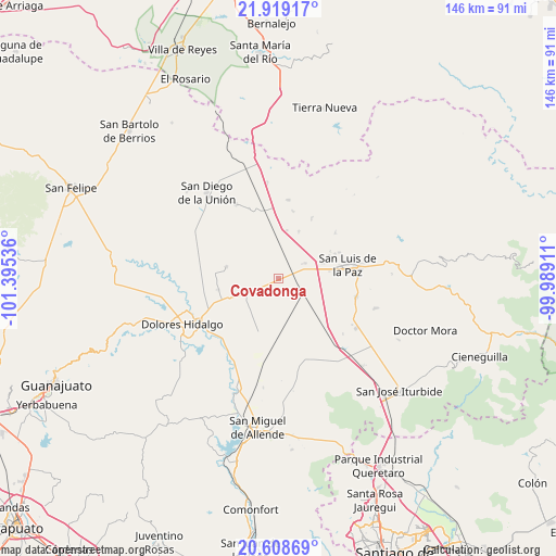
Covadonga GPS coordinates[2]
21° 15' 55.404" North, 100° 41' 32.028" West
| Map corner | latitude | longitude |
|---|---|---|
| Upper-left | 21.91917°, | -101.39536° |
| Center: | 21.26539°, | -100.69223° |
| Lower-right: | 20.60869°, | -99.98911° |
| Map W x H: | 145.7×145.7 km | = 90.5×90.5mi |
| max Lat: | 32.7° ⇑20.3% North |
| Covadonga: | 21.26539° |
| min Lat: | ⇓79.7% South 14.53588° |
| min Long | Covadonga | max Long |
| -117.105° | -100.69223° | -86.73105° |
| W 29%⇐ | ⇒71% E |
Elevation
Elevation of Covadonga is 2003 m = 6572 ft, and this is 749.3 m = 2458 ft above average elevation for this country.
| Max E: |
3497 m = 11473 ft | 26.4% |
| Covadonga | 2003 m 6572 ft | |
| Avg. | 1253.7 m = 4113 ft | |
Min E: |
-1 m = -3 ft | 73.6% |
See also: Mexico elevation on elevation.city.
Geographical zone
Covadonga is located in North Torrid zone (between Equator and Tropic of Cancer). Distance of this Northern Tropic circle is 241.4 km =150 mi to North.| Distance of | km | miles | from Covadonga |
|---|---|---|---|
| North Pole | 7642.6 | 4748.9 | to North |
| Arctic Circle | 5036.7 | 3129.7 | to North |
| Tropic Cancer | 241.4 | 150 | to North |
| Equator | 2364.5 | 1469.2 | to South |


Nearby cities:
15 places around Covadonga: (largest is in red/bold)
• Adjuntas del Monte
11.6 km =7.2 mi,  293°
293°
• Catalán del Refugio (Catalanes)
8 km =5 mi,  324°
324°
• El Rosalito
13.4 km =8.3 mi,  23°
23°
• El Álamo
5.1 km =3.2 mi,  211°
211°
• Garabatillo
7.9 km =4.9 mi,  312°
312°
• Jamaica
14.2 km =8.8 mi,  197°
197°
• La California
13.9 km =8.6 mi,  283°
283°
• La Escondidita
8 km =5 mi,  60°
60°
• La Laguna Seca
4.8 km =3 mi,  104°
104°
• La Sabana
7.3 km =4.5 mi,  177°
177°
• Lourdes (Estación de Lourdes)
3 km =1.9 mi,  334°
334°
• Palma Prieta
1.8 km =1.1 mi,  242°
242°
• Pozo Blanco
4.9 km =3 mi,  67°
67°
• San Isidro de la Estacada
13.1 km =8.1 mi, 176°
• San Pablo
9.9 km =6.2 mi, 182°
Sources, notices
• [Note1] Compared only with cities in Mexico existing in our database
• [Src1] Map data: © OpenStreetMap contributors (CC-BY-SA)
• [Src2] Other city data from geonames.org with taken over terms of usage.
• [Src3] Geographical zone / Annual Mean Temperature by Robert A. Rohde @ Wikipedia
