San Felipe Quiriceo geodata
San Felipe Quiriceo (Guanajuato) is a populated place; located in Mexico in America/Mexico_City (GMT-6) time zone. With population of 1,033 people, there are 8436 cities with bigger population in this country. Compared to other cities in Mexico, 66.6% of cities are located further ↓South; 75.6% of cities are located further →East and 59.7% of cities have lower elevation than San Felipe Quiriceo. Note1


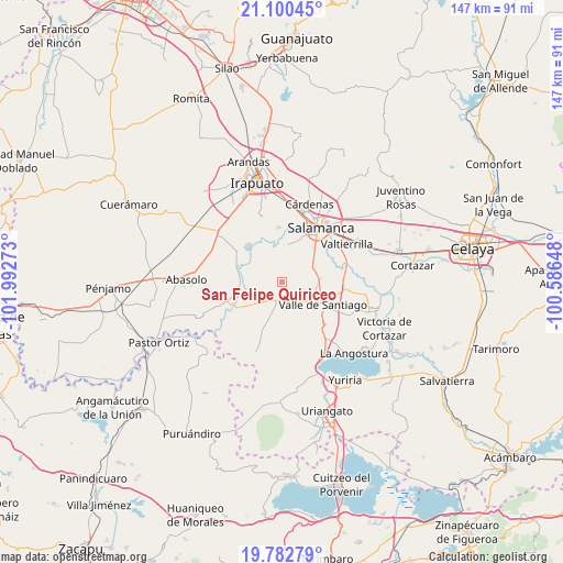
San Felipe Quiriceo GPS coordinates[2]
20° 26' 34.908" North, 101° 17' 22.56" West
| Map corner | latitude | longitude |
|---|---|---|
| Upper-left | 21.10045°, | -101.99273° |
| Center: | 20.44303°, | -101.2896° |
| Lower-right: | 19.78279°, | -100.58648° |
| Map W x H: | 146.5×146.5 km | = 91×91mi |
| max Lat: | 32.7° ⇑33.4% North |
| San Felipe Quiriceo: | 20.44303° |
| min Lat: | ⇓66.6% South 14.53588° |
| min Long | San Felipe Quir | max Long |
| -117.105° | -101.2896° | -86.73105° |
| W 24.4%⇐ | ⇒75.6% E |
Elevation
Elevation of San Felipe Quiriceo is 1721 m = 5646 ft, and this is 467.3 m = 1533 ft above average elevation for this country.
| Max E: |
3497 m = 11473 ft | 40.3% |
| San Felipe Quiriceo | 1721 m 5646 ft | |
| Avg. | 1253.7 m = 4113 ft | |
Min E: |
-1 m = -3 ft | 59.7% |
See also: Mexico elevation on elevation.city.
Geographical zone
San Felipe Quiriceo is located in North Torrid zone (between Equator and Tropic of Cancer). Distance of this Northern Tropic circle is 332.9 km =206.9 mi to North.| Distance of | km | miles | from San Felipe Quiriceo |
|---|---|---|---|
| North Pole | 7734 | 4805.7 | to North |
| Arctic Circle | 5128.1 | 3186.5 | to North |
| Tropic Cancer | 332.9 | 206.9 | to North |
| Equator | 2273.1 | 1412.4 | to South |


Nearby cities:
15 places around San Felipe Quiriceo: (largest is in red/bold)
• Callejones y Granados
7.1 km =4.4 mi,  58°
58°
• Cerro Colorado
5.9 km =3.7 mi,  217°
217°
• El Tambor
6.2 km =3.9 mi,  348°
348°
• Labor de Valtierra
6.3 km =3.9 mi,  36°
36°
• Mogotes de San José Parangueo
3.4 km =2.1 mi,  201°
201°
• Noria de Mosqueda
7 km =4.3 mi,  304°
304°
• Quiriceo
2.5 km =1.6 mi,  256°
256°
• Rincón de Parangueo
4.7 km =2.9 mi,  120°
120°
• San Diego Quiriceo
1.1 km =0.7 mi,  338°
338°
• San Ignacio de San José Parangueo
3.3 km =2.1 mi, 195°
• San Isidro de Mogotes
2.6 km =1.6 mi,  144°
144°
• San Nicolás Parangueo
6.7 km =4.2 mi,  145°
145°
• San Nicolás Quiriceo
1.2 km =0.7 mi,  12°
12°
• Santa Bárbara
7.2 km =4.5 mi, 300°
• Zapote de San Vicente
5.8 km =3.6 mi,  92°
92°
Sources, notices
• [Note1] Compared only with cities in Mexico existing in our database
• [Src1] Map data: © OpenStreetMap contributors (CC-BY-SA)
• [Src2] Other city data from geonames.org with taken over terms of usage.
• [Src3] Geographical zone / Annual Mean Temperature by Robert A. Rohde @ Wikipedia
