San Nicolás Parangueo geodata
San Nicolás Parangueo (Guanajuato) is a populated place; located in Mexico in America/Mexico_City (GMT-6) time zone. With population of 1,581 people, there are 5458 cities with bigger population in this country. Compared to other cities in Mexico, 65.5% of cities are located further ↓South; 75.3% of cities are located further →East and 61% of cities have lower elevation than San Nicolás Parangueo. Note1
Current local time in San Nicolás Parangueo:
08:26 AM, WednesdayDifference from your time zone: hours


San Nicolás Parangueo GPS coordinates[2]
20° 23' 36.816" North, 101° 15' 13.104" West
| Map corner | latitude | longitude |
|---|---|---|
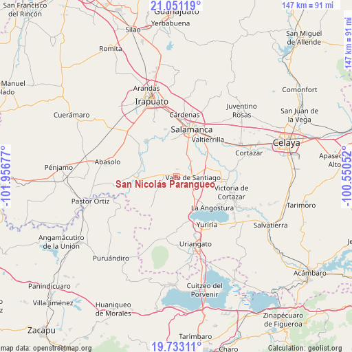
| Upper-left | 21.05119°, | -101.95677° |
| Center: | 20.39356°, | -101.25364° |
| Lower-right: | 19.73311°, | -100.55052° |
| Map W x H: | 146.6×146.6 km | = 91.1×91.1mi |
| max Lat: | 32.7° ⇑34.5% North |
| San Nicolás Parangueo: | 20.39356° |
| min Lat: | ⇓65.5% South 14.53588° |
| min Long | San Nicolás Pa | max Long |
| -117.105° | -101.25364° | -86.73105° |
| W 24.7%⇐ | ⇒75.3% E |
Elevation
Elevation of San Nicolás Parangueo is 1743 m = 5719 ft, and this is 489.3 m = 1605 ft above average elevation for this country.
| Max E: |
3497 m = 11473 ft | 39% |
| San Nicolás Parangueo | 1743 m 5719 ft | |
| Avg. | 1253.7 m = 4113 ft | |
Min E: |
-1 m = -3 ft | 61% |
See also: Mexico elevation on elevation.city.
Geographical zone
San Nicolás Parangueo is located in North Torrid zone (between Equator and Tropic of Cancer). Distance of this Northern Tropic circle is 338.4 km =210.3 mi to North.| Distance of | km | miles | from San Nicolás Parangueo |
|---|---|---|---|
| North Pole | 7739.5 | 4809.1 | to North |
| Arctic Circle | 5133.6 | 3189.9 | to North |
| Tropic Cancer | 338.4 | 210.3 | to North |
| Equator | 2267.6 | 1409 | to South |


Nearby cities:
15 places around San Nicolás Parangueo: (largest is in red/bold)
• Cerro Colorado
7.4 km =4.6 mi,  276°
276°
• Crucitas
6.4 km =4 mi,  128°
128°
• Hoya de Cintora (La Hoya de Arriba)
5.7 km =3.5 mi,  124°
124°
• Loma Tendida
6.3 km =3.9 mi,  251°
251°
• Mogotes de San José Parangueo
5.5 km =3.4 mi,  295°
295°
• Rancho Nuevo de San Andrés
3.6 km =2.2 mi,  240°
240°
• Ranchos Unidos
7.4 km =4.6 mi,  141°
141°
• Rincón de Parangueo
3.2 km =2 mi,  4°
4°
• San Felipe Quiriceo
6.7 km =4.2 mi,  325°
325°
• San Ignacio de San José Parangueo
5.2 km =3.2 mi, 297°
• San Isidro de Mogotes
4.1 km =2.5 mi, 326°
• San Vicente de Garma (Garma)
5.8 km =3.6 mi,  50°
50°
• Valle de Santiago
6.4 km =4 mi,  92°
92°
• Zapote de San Vicente
5.7 km =3.5 mi,  21°
21°
• Zapotillo de Mogotes
1.8 km =1.1 mi,  160°
160°
Sources, notices
• [Note1] Compared only with cities in Mexico existing in our database
• [Src1] Map data: © OpenStreetMap contributors (CC-BY-SA)
• [Src2] Other city data from geonames.org with taken over terms of usage.
• [Src3] Geographical zone / Annual Mean Temperature by Robert A. Rohde @ Wikipedia
