Cuchicuato geodata
Cuchicuato (Guanajuato) is a populated place; located in Mexico in America/Mexico_City (GMT-6) time zone. With population of 2,896 people, there are 3073 cities with bigger population in this country. Compared to other cities in Mexico, 71.1% of cities are located further ↓South; 77.1% of cities are located further →East and 60.7% of cities have lower elevation than Cuchicuato. Note1


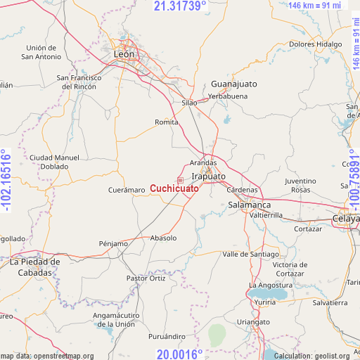
Cuchicuato GPS coordinates[2]
20° 39' 39.312" North, 101° 27' 43.308" West
| Map corner | latitude | longitude |
|---|---|---|
| Upper-left | 21.31739°, | -102.16516° |
| Center: | 20.66092°, | -101.46203° |
| Lower-right: | 20.0016°, | -100.75891° |
| Map W x H: | 146.3×146.3 km | = 90.9×90.9mi |
| max Lat: | 32.7° ⇑28.9% North |
| Cuchicuato: | 20.66092° |
| min Lat: | ⇓71.1% South 14.53588° |
| min Long | Cuchicuato | max Long |
| -117.105° | -101.46203° | -86.73105° |
| W 22.9%⇐ | ⇒77.1% E |
Elevation
Elevation of Cuchicuato is 1738 m = 5702 ft, and this is 484.3 m = 1589 ft above average elevation for this country.
| Max E: |
3497 m = 11473 ft | 39.3% |
| Cuchicuato | 1738 m 5702 ft | |
| Avg. | 1253.7 m = 4113 ft | |
Min E: |
-1 m = -3 ft | 60.7% |
See also: Mexico elevation on elevation.city.
Geographical zone
Cuchicuato is located in North Torrid zone (between Equator and Tropic of Cancer). Distance of this Northern Tropic circle is 308.6 km =191.8 mi to North.| Distance of | km | miles | from Cuchicuato |
|---|---|---|---|
| North Pole | 7709.8 | 4790.6 | to North |
| Arctic Circle | 5103.9 | 3171.4 | to North |
| Tropic Cancer | 308.6 | 191.8 | to North |
| Equator | 2297.3 | 1427.5 | to South |


Nearby cities:
15 places around Cuchicuato: (largest is in red/bold)
• Colonia Vista Alegre
6.3 km =3.9 mi,  72°
72°
• Fraccionamiento las Liebres
7.1 km =4.4 mi,  102°
102°
• Guadalupe de Rivera
6.2 km =3.9 mi,  185°
185°
• Horta (San Antonio de Horta)
6.3 km =3.9 mi,  232°
232°
• La Caja
6.2 km =3.9 mi,  24°
24°
• Las Huertas Tercera Sección
7.2 km =4.5 mi, 97°
• Purísima de Covarrubias
5.1 km =3.2 mi,  205°
205°
• Rancho Nuevo de Dolores (El Cuero)
6.2 km =3.9 mi,  127°
127°
• Rancho Nuevo de la Cruz
5.9 km =3.7 mi,  259°
259°
• Rivera de Guadalupe
5.3 km =3.3 mi,  178°
178°
• San Cristóbal
1.6 km =1 mi, 257°
• San Javier
3.5 km =2.2 mi,  78°
78°
• San José de Bernalejo (El Guayabo)
6.7 km =4.2 mi,  110°
110°
• San José de Jorge López
6.6 km =4.1 mi, 81°
• Villas de Irapuato
6.6 km =4.1 mi,  63°
63°
Sources, notices
• [Note1] Compared only with cities in Mexico existing in our database
• [Src1] Map data: © OpenStreetMap contributors (CC-BY-SA)
• [Src2] Other city data from geonames.org with taken over terms of usage.
• [Src3] Geographical zone / Annual Mean Temperature by Robert A. Rohde @ Wikipedia
