Rivera de Guadalupe geodata
Rivera de Guadalupe (Guanajuato) is a populated place; located in Mexico in America/Mexico_City (GMT-6) time zone. With population of 988 people, there are 8815 cities with bigger population in this country. Compared to other cities in Mexico, 70.3% of cities are located further ↓South; 77% of cities are located further →East and 59.7% of cities have lower elevation than Rivera de Guadalupe. Note1


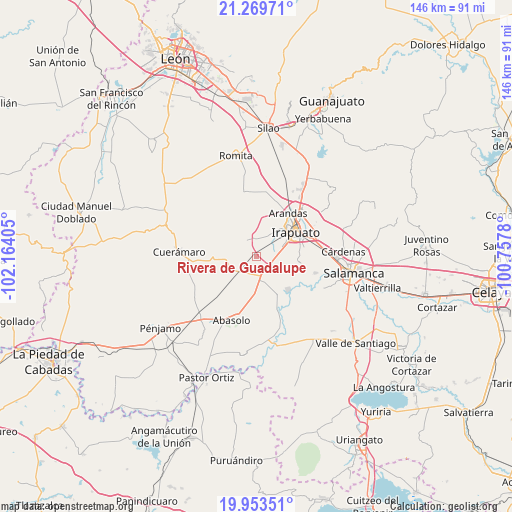
Rivera de Guadalupe GPS coordinates[2]
20° 36' 46.908" North, 101° 27' 39.312" West
| Map corner | latitude | longitude |
|---|---|---|
| Upper-left | 21.26971°, | -102.16405° |
| Center: | 20.61303°, | -101.46092° |
| Lower-right: | 19.95351°, | -100.7578° |
| Map W x H: | 146.3×146.3 km | = 90.9×90.9mi |
| max Lat: | 32.7° ⇑29.7% North |
| Rivera de Guadalupe: | 20.61303° |
| min Lat: | ⇓70.3% South 14.53588° |
| min Long | Rivera de Guada | max Long |
| -117.105° | -101.46092° | -86.73105° |
| W 23%⇐ | ⇒77% E |
Elevation
Elevation of Rivera de Guadalupe is 1721 m = 5646 ft, and this is 467.3 m = 1533 ft above average elevation for this country.
| Max E: |
3497 m = 11473 ft | 40.3% |
| Rivera de Guadalupe | 1721 m 5646 ft | |
| Avg. | 1253.7 m = 4113 ft | |
Min E: |
-1 m = -3 ft | 59.7% |
See also: Mexico elevation on elevation.city.
Geographical zone
Rivera de Guadalupe is located in North Torrid zone (between Equator and Tropic of Cancer). Distance of this Northern Tropic circle is 314 km =195.1 mi to North.| Distance of | km | miles | from Rivera de Guadalupe |
|---|---|---|---|
| North Pole | 7715.1 | 4793.9 | to North |
| Arctic Circle | 5109.2 | 3174.7 | to North |
| Tropic Cancer | 314 | 195.1 | to North |
| Equator | 2292 | 1424.2 | to South |


Nearby cities:
15 places around Rivera de Guadalupe: (largest is in red/bold)
• Colonia Morelos de Guadalupe de Rivera
2.3 km =1.4 mi,  145°
145°
• Cuchicuato
5.3 km =3.3 mi,  358°
358°
• El Romeral
3.4 km =2.1 mi,  179°
179°
• Guadalupe de Rivera
1.1 km =0.7 mi,  217°
217°
• Horta (San Antonio de Horta)
5.3 km =3.3 mi,  286°
286°
• La Soledad
4.8 km =3 mi,  96°
96°
• La Trinidad
4.2 km =2.6 mi, 219°
• Providencia de Pérez
3.7 km =2.3 mi, 102°
• Purísima de Covarrubias
2.4 km =1.5 mi, 286°
• Rancho Nuevo de Dolores (El Cuero)
5.1 km =3.2 mi,  71°
71°
• San Cristóbal
5.3 km =3.3 mi,  341°
341°
• San Ignacio de Rivera (Ojo de Agua)
6 km =3.7 mi, 180°
• San Javier
6.9 km =4.3 mi,  28°
28°
• San José de Bernalejo (El Guayabo)
6.9 km =4.3 mi,  64°
64°
• San Luis del Jánamo (El Morado)
2.8 km =1.7 mi,  164°
164°
Sources, notices
• [Note1] Compared only with cities in Mexico existing in our database
• [Src1] Map data: © OpenStreetMap contributors (CC-BY-SA)
• [Src2] Other city data from geonames.org with taken over terms of usage.
• [Src3] Geographical zone / Annual Mean Temperature by Robert A. Rohde @ Wikipedia
