Poblado Lázaro Cárdenas (La Veintiocho) geodata
Poblado Lázaro Cárdenas (La Veintiocho) (Baja California) is a populated place; located in Mexico in America/Tijuana (GMT-7) time zone. With population of 2,388 people, there are 3697 cities with bigger population in this country. Compared to other cities in Mexico, 99.5% of cities are located further ↓South; 99.2% of cities are located further →East and 92.1% of cities have higher elevation than Poblado Lázaro Cárdenas (La Veintiocho). Note1
Current local time in Poblado Lázaro Cárdenas (La Veintiocho):
07:29 AM, WednesdayDifference from your time zone: hours


Poblado Lázaro Cárdenas (La Veintiocho) GPS coordinates[2]
32° 22' 23.988" North, 115° 3' 55.008" West
| Map corner | latitude | longitude |
|---|---|---|
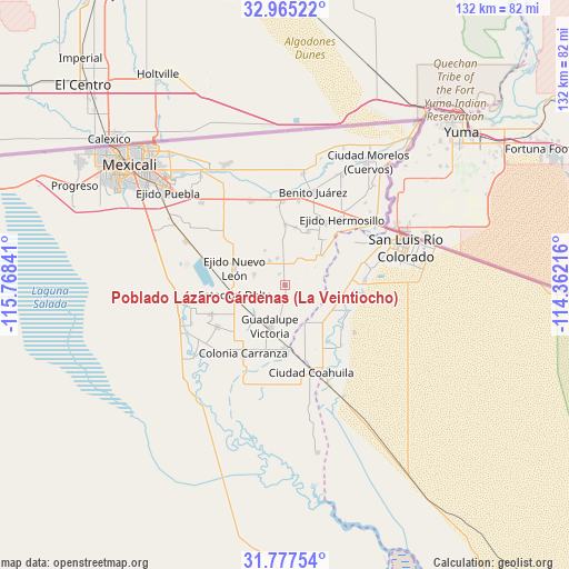
| Upper-left | 32.96522°, | -115.76841° |
| Center: | 32.37333°, | -115.06528° |
| Lower-right: | 31.77754°, | -114.36216° |
| Map W x H: | 132.1×132.1 km | = 82.1×82.1mi |
| max Lat: | 32.7° ⇑0.5% North |
| Poblado Lázaro Cárdenas (La Veintiocho): | 32.37333° |
| min Lat: | ⇓99.5% South 14.53588° |
| min Long | Poblado Lázaro | max Long |
| -117.105° | -115.06528° | -86.73105° |
| W 0.8%⇐ | ⇒99.2% E |
Elevation
Elevation of Poblado Lázaro Cárdenas (La Veintiocho) is 19 m = 62 ft, and this is 1234.7 m = 4051 ft below average elevation for this country.
| Max E: |
3497 m = 11473 ft | 92.1% |
| Avg. | 1253.7 m = 4113 ft | |
| Poblado Lázaro Cárdenas (La Veintiocho) | 19 m = 62 ft | |
Min E: |
-1 m = -3 ft | 7.9% |
See also: Mexico elevation on elevation.city.
Geographical zone
Poblado Lázaro Cárdenas (La Veintiocho) is located in North temperate zone (between Tropic of Cancer and the Arctic Circle). Distance of this Northern Tropic circle is 993.7 km =617.5 mi to South.| Distance of | km | miles | from Poblado Lázaro Cárdenas (La Veintiocho) |
|---|---|---|---|
| North Pole | 6407.5 | 3981.4 | to North |
| Arctic Circle | 3801.6 | 2362.2 | to North |
| Tropic Cancer | 993.7 | 617.5 | to South |
| Equator | 3599.6 | 2236.7 | to South |


Nearby cities:
15 places around Poblado Lázaro Cárdenas (La Veintiocho): (largest is in red/bold)
• Delta
12.5 km =7.8 mi,  260°
260°
• Ejido Distrito Federal
13.7 km =8.5 mi,  10°
10°
• Ejido Jiquilpan
14.2 km =8.8 mi,  0°
0°
• Ejido Nuevo León
12.3 km =7.6 mi,  289°
289°
• Ejido Pátzcuaro
2.4 km =1.5 mi,  181°
181°
• Ejido Quintana Roo
10.7 km =6.6 mi,  351°
351°
• Ejido Saltillo
8 km =5 mi,  315°
315°
• Ejido Tlaxcala
9.2 km =5.7 mi,  330°
330°
• Ejido Toluca
6.6 km =4.1 mi, 345°
• Ejido Vicente Guerrero
7.5 km =4.7 mi, 289°
• Estación Pescaderos
9.7 km =6 mi,  225°
225°
• Guadalupe Victoria
10.1 km =6.3 mi,  201°
201°
• Poblado Alfredo V. Bonfil
3.5 km =2.2 mi, 184°
• Poblado Francisco Santana Peralta
10.7 km =6.6 mi,  358°
358°
• Ricardo Mazón Guerrero (Colonia Baja California el Polvorín)
15.2 km =9.4 mi,  193°
193°
Sources, notices
• [Note1] Compared only with cities in Mexico existing in our database
• [Src1] Map data: © OpenStreetMap contributors (CC-BY-SA)
• [Src2] Other city data from geonames.org with taken over terms of usage.
• [Src3] Geographical zone / Annual Mean Temperature by Robert A. Rohde @ Wikipedia
