San Rafael Tlanalapan geodata
San Rafael Tlanalapan (Puebla) is a populated place; located in Mexico in America/Mexico_City (GMT-6) time zone. With population of 15,998 people, there are 602 cities with bigger population in this country. Compared to other cities in Mexico, 59% of cities are located further ↑North; 57.7% of cities are located further ←West and 86.4% of cities have lower elevation than San Rafael Tlanalapan. Note1


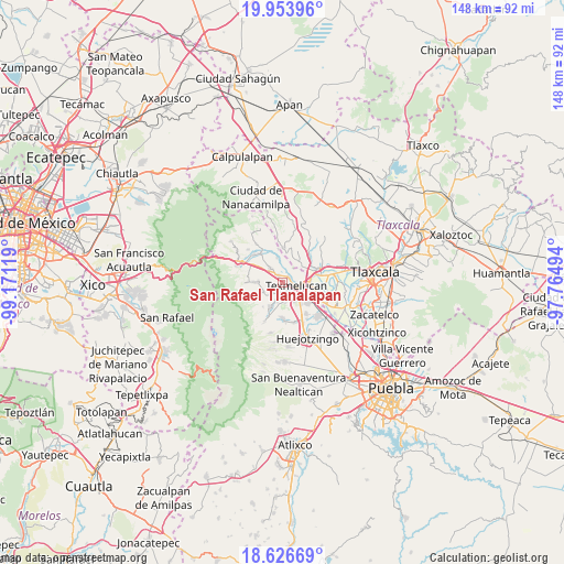
San Rafael Tlanalapan GPS coordinates[2]
19° 17' 30.012" North, 98° 28' 5.016" West
| Map corner | latitude | longitude |
|---|---|---|
| Upper-left | 19.95396°, | -99.17119° |
| Center: | 19.29167°, | -98.46806° |
| Lower-right: | 18.62669°, | -97.76494° |
| Map W x H: | 147.6×147.6 km | = 91.7×91.7mi |
| max Lat: | 32.7° ⇑59% North |
| San Rafael Tlanalapan: | 19.29167° |
| min Lat: | ⇓41% South 14.53588° |
| min Long | San Rafael Tlan | max Long |
| -117.105° | -98.46806° | -86.73105° |
| W 57.7%⇐ | ⇒42.3% E |
Elevation
Elevation of San Rafael Tlanalapan is 2294 m = 7526 ft, and this is 1040.3 m = 3413 ft above average elevation for this country.
| Max E: |
3497 m = 11473 ft | 13.6% |
| San Rafael Tlanalapan | 2294 m 7526 ft | |
| Avg. | 1253.7 m = 4113 ft | |
Min E: |
-1 m = -3 ft | 86.4% |
See also: Mexico elevation on elevation.city.
Geographical zone
San Rafael Tlanalapan is located in North Torrid zone (between Equator and Tropic of Cancer). Distance of this Northern Tropic circle is 460.9 km =286.4 mi to North.| Distance of | km | miles | from San Rafael Tlanalapan |
|---|---|---|---|
| North Pole | 7862 | 4885.2 | to North |
| Arctic Circle | 5256.1 | 3266 | to North |
| Tropic Cancer | 460.9 | 286.4 | to North |
| Equator | 2145 | 1332.8 | to South |


Nearby cities:
15 places around San Rafael Tlanalapan: (largest is in red/bold)
• Analco de Ponciano Arriaga (Santa Cruz Analco)
4.5 km =2.8 mi,  228°
228°
• Espíritu Santo
6.8 km =4.2 mi,  39°
39°
• Palmillas
5.2 km =3.2 mi,  305°
305°
• San Buenaventura Tecaltzingo
4.9 km =3 mi,  170°
170°
• San Francisco Tepeyecac
5.7 km =3.5 mi,  146°
146°
• San Gregorio Aztotoacan
3.9 km =2.4 mi,  219°
219°
• San Juan Tuxco
4 km =2.5 mi, 154°
• San Lucas el Grande
1.9 km =1.2 mi,  325°
325°
• San Martin Texmelucan de Labastida
3.2 km =2 mi,  104°
104°
• San Matias Tlalancaleca
4.9 km =3 mi,  319°
319°
• San Matías Atzala
4.7 km =2.9 mi,  197°
197°
• San Miguel Tianguistenco
6.6 km =4.1 mi,  272°
272°
• San Salvador el Verde
5.6 km =3.5 mi,  244°
244°
• San Simón Atzitzintla
3.3 km =2.1 mi,  194°
194°
• Tlacotepec de José Manzo
2.8 km =1.7 mi, 218°
Sources, notices
• [Note1] Compared only with cities in Mexico existing in our database
• [Src1] Map data: © OpenStreetMap contributors (CC-BY-SA)
• [Src2] Other city data from geonames.org with taken over terms of usage.
• [Src3] Geographical zone / Annual Mean Temperature by Robert A. Rohde @ Wikipedia
