Heriberto Valdez Romero (El Guayabo) geodata
Heriberto Valdez Romero (El Guayabo) (Sinaloa) is a populated place; located in Mexico in America/Mazatlan (GMT-7) time zone. With population of 2,065 people, there are 4226 cities with bigger population in this country. Compared to other cities in Mexico, 95.1% of cities are located further ↓South; 97.2% of cities are located further →East and 92.1% of cities have higher elevation than Heriberto Valdez Romero (El Guayabo). Note1
Current local time in Heriberto Valdez Romero (El Guayabo):
10:18 AM, MondayDifference from your time zone: hours


Heriberto Valdez Romero (El Guayabo) GPS coordinates[2]
25° 56' 26.016" North, 109° 8' 13.992" West
| Map corner | latitude | longitude |
|---|---|---|
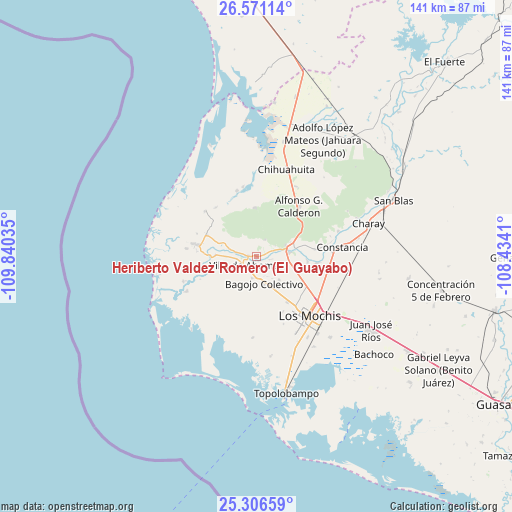
| Upper-left | 26.57114°, | -109.84035° |
| Center: | 25.94056°, | -109.13722° |
| Lower-right: | 25.30659°, | -108.4341° |
| Map W x H: | 140.6×140.6 km | = 87.4×87.4mi |
| max Lat: | 32.7° ⇑4.9% North |
| Heriberto Valdez Romero (El Guayabo): | 25.94056° |
| min Lat: | ⇓95.1% South 14.53588° |
| min Long | Heriberto Valde | max Long |
| -117.105° | -109.13722° | -86.73105° |
| W 2.8%⇐ | ⇒97.2% E |
Elevation
Elevation of Heriberto Valdez Romero (El Guayabo) is 19 m = 62 ft, and this is 1234.7 m = 4051 ft below average elevation for this country.
| Max E: |
3497 m = 11473 ft | 92.1% |
| Avg. | 1253.7 m = 4113 ft | |
| Heriberto Valdez Romero (El Guayabo) | 19 m = 62 ft | |
Min E: |
-1 m = -3 ft | 7.9% |
See also: Mexico elevation on elevation.city.
Geographical zone
Heriberto Valdez Romero (El Guayabo) is located in North temperate zone (between Tropic of Cancer and the Arctic Circle). Distance of this Northern Tropic circle is 278.4 km =173 mi to South.| Distance of | km | miles | from Heriberto Valdez Romero (El Guayabo) |
|---|---|---|---|
| North Pole | 7122.7 | 4425.8 | to North |
| Arctic Circle | 4516.9 | 2806.7 | to North |
| Tropic Cancer | 278.4 | 173 | to South |
| Equator | 2884.3 | 1792.2 | to South |


Nearby cities:
15 places around Heriberto Valdez Romero (El Guayabo): (largest is in red/bold)
• Agua Nueva
7.6 km =4.7 mi,  145°
145°
• Ahome
4.3 km =2.7 mi,  237°
237°
• Bagojo Colectivo
7.6 km =4.7 mi,  165°
165°
• Cuchilla de Cachoana
7.5 km =4.7 mi,  159°
159°
• Ejido Cohuibampo
2.2 km =1.4 mi,  271°
271°
• Ejido Mayocoba
8.4 km =5.2 mi, 268°
• Ejido Tosalibampo
5.1 km =3.2 mi,  28°
28°
• El Guayabo
0.2 km =0.1 mi,  298°
298°
• El Porvenir
4.1 km =2.5 mi,  102°
102°
• Goros Pueblo
6.1 km =3.8 mi,  75°
75°
• Los Suárez
5.4 km =3.4 mi,  283°
283°
• Macapul (Almacenes)
6 km =3.7 mi,  177°
177°
• Macapule
6.2 km =3.9 mi,  190°
190°
• Nuevo San Miguel
8.7 km =5.4 mi,  73°
73°
• San Miguel Zapotitlan
9 km =5.6 mi, 84°
Sources, notices
• [Note1] Compared only with cities in Mexico existing in our database
• [Src1] Map data: © OpenStreetMap contributors (CC-BY-SA)
• [Src2] Other city data from geonames.org with taken over terms of usage.
• [Src3] Geographical zone / Annual Mean Temperature by Robert A. Rohde @ Wikipedia
