Guadalupe Minerva geodata
Guadalupe Minerva (Hidalgo) is a populated place; located in Mexico in America/Mexico_City (GMT-6) time zone. With population of 1,969 people, there are 4429 cities with bigger population in this country. Compared to other cities in Mexico, 59.7% of cities are located further ↓South; 54.9% of cities are located further ←West and 92.2% of cities have lower elevation than Guadalupe Minerva. Note1


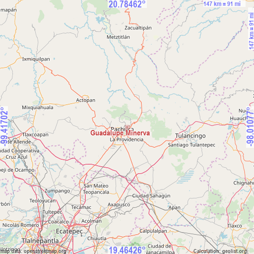
Guadalupe Minerva GPS coordinates[2]
20° 7' 32.988" North, 98° 42' 50.004" West
| Map corner | latitude | longitude |
|---|---|---|
| Upper-left | 20.78462°, | -99.41702° |
| Center: | 20.12583°, | -98.71389° |
| Lower-right: | 19.46426°, | -98.01077° |
| Map W x H: | 146.8×146.8 km | = 91.2×91.2mi |
| max Lat: | 32.7° ⇑40.3% North |
| Guadalupe Minerva: | 20.12583° |
| min Lat: | ⇓59.7% South 14.53588° |
| min Long | Guadalupe Miner | max Long |
| -117.105° | -98.71389° | -86.73105° |
| W 54.9%⇐ | ⇒45.1% E |
Elevation
Elevation of Guadalupe Minerva is 2492 m = 8176 ft, and this is 1238.3 m = 4063 ft above average elevation for this country.
| Max E: |
3497 m = 11473 ft | 7.8% |
| Guadalupe Minerva | 2492 m 8176 ft | |
| Avg. | 1253.7 m = 4113 ft | |
Min E: |
-1 m = -3 ft | 92.2% |
See also: Mexico elevation on elevation.city.
Geographical zone
Guadalupe Minerva is located in North Torrid zone (between Equator and Tropic of Cancer). Distance of this Northern Tropic circle is 368.1 km =228.7 mi to North.| Distance of | km | miles | from Guadalupe Minerva |
|---|---|---|---|
| North Pole | 7769.3 | 4827.6 | to North |
| Arctic Circle | 5163.4 | 3208.4 | to North |
| Tropic Cancer | 368.1 | 228.7 | to North |
| Equator | 2237.8 | 1390.5 | to South |


Nearby cities:
15 places around Guadalupe Minerva: (largest is in red/bold)
• Camelia (Barrio la Camelia)
2.7 km =1.7 mi,  341°
341°
• Campestre Villas del Álamo
2.8 km =1.7 mi,  165°
165°
• Colonia Militar
2 km =1.2 mi,  144°
144°
• El Álamo
3.5 km =2.2 mi,  175°
175°
• Manuel Ávila Camacho
1.7 km =1.1 mi,  154°
154°
• Pachuca de Soto
2.3 km =1.4 mi,  244°
244°
• Privada del Álamo
3.4 km =2.1 mi,  155°
155°
• Privadas de San Javier
3.2 km =2 mi,  191°
191°
• Real de Oriente
2.5 km =1.6 mi,  207°
207°
• Rio de la Soledad
1.2 km =0.7 mi, 170°
• San Guillermo la Reforma
1.7 km =1.1 mi,  111°
111°
• Santiago Jaltepec
1.8 km =1.1 mi, 170°
• Unidad Habitacional CTM
2.9 km =1.8 mi, 194°
• Unidad Minera 11 de Julio
2.5 km =1.6 mi,  201°
201°
• Álamo Rustico
2.8 km =1.7 mi, 184°
Sources, notices
• [Note1] Compared only with cities in Mexico existing in our database
• [Src1] Map data: © OpenStreetMap contributors (CC-BY-SA)
• [Src2] Other city data from geonames.org with taken over terms of usage.
• [Src3] Geographical zone / Annual Mean Temperature by Robert A. Rohde @ Wikipedia
