El Porvenir I geodata
El Porvenir I (State of Mexico) is a populated place; located in Mexico in America/Mexico_City (GMT-6) time zone. With population of 1,514 people, there are 5695 cities with bigger population in this country. Compared to other cities in Mexico, 58.5% of cities are located further ↑North; 60.6% of cities are located further →East and 97.2% of cities have lower elevation than El Porvenir I. Note1


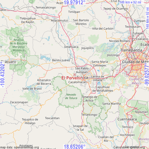
El Porvenir I GPS coordinates[2]
19° 19' 0.984" North, 99° 43' 44.004" West
| Map corner | latitude | longitude |
|---|---|---|
| Upper-left | 19.97912°, | -100.43202° |
| Center: | 19.31694°, | -99.72889° |
| Lower-right: | 18.65206°, | -99.02577° |
| Map W x H: | 147.6×147.6 km | = 91.7×91.7mi |
| max Lat: | 32.7° ⇑58.5% North |
| El Porvenir I: | 19.31694° |
| min Lat: | ⇓41.5% South 14.53588° |
| min Long | El Porvenir I | max Long |
| -117.105° | -99.72889° | -86.73105° |
| W 39.4%⇐ | ⇒60.6% E |
Elevation
Elevation of El Porvenir I is 2696 m = 8845 ft, and this is 1442.3 m = 4732 ft above average elevation for this country.
| Max E: |
3497 m = 11473 ft | 2.8% |
| El Porvenir I | 2696 m 8845 ft | |
| Avg. | 1253.7 m = 4113 ft | |
Min E: |
-1 m = -3 ft | 97.2% |
See also: Mexico elevation on elevation.city.
Geographical zone
El Porvenir I is located in North Torrid zone (between Equator and Tropic of Cancer). Distance of this Northern Tropic circle is 458.1 km =284.7 mi to North.| Distance of | km | miles | from El Porvenir I |
|---|---|---|---|
| North Pole | 7859.2 | 4883.5 | to North |
| Arctic Circle | 5253.3 | 3264.2 | to North |
| Tropic Cancer | 458.1 | 284.7 | to North |
| Equator | 2147.8 | 1334.6 | to South |


Nearby cities:
15 places around El Porvenir I: (largest is in red/bold)
• Besana Ancha
4 km =2.5 mi,  251°
251°
• Calixtlahuaca
4.7 km =2.9 mi,  62°
62°
• Cerro del Murciélago
4.7 km =2.9 mi,  214°
214°
• Colonia la Virgen
1.5 km =0.9 mi,  168°
168°
• Conjunto Urbano la Loma I
1.1 km =0.7 mi,  343°
343°
• Ejido San Lorenzo Cuauhtenco
2.8 km =1.7 mi,  232°
232°
• La Cabecera
4.8 km =3 mi, 335°
• San Francisco Tlalcilalcalpan
4.8 km =3 mi,  238°
238°
• San José Barbabosa
4.7 km =2.9 mi, 168°
• San Marcos Yachihuacaltepec
5.3 km =3.3 mi,  82°
82°
• San Martín Toltepec
4.6 km =2.9 mi,  31°
31°
• San Mateo Tlalchichilpan
4.2 km =2.6 mi,  313°
313°
• Santiaguito Tlalcilalcalli
2.6 km =1.6 mi,  3°
3°
• Tecaxic
1.6 km =1 mi,  65°
65°
• Zinacantepec
3.7 km =2.3 mi,  188°
188°
Sources, notices
• [Note1] Compared only with cities in Mexico existing in our database
• [Src1] Map data: © OpenStreetMap contributors (CC-BY-SA)
• [Src2] Other city data from geonames.org with taken over terms of usage.
• [Src3] Geographical zone / Annual Mean Temperature by Robert A. Rohde @ Wikipedia
