Zinacantepec geodata
Zinacantepec (State of Mexico) is a seat of a second-order administrative division; located in Mexico in America/Mexico_City (GMT-6) time zone. With population of 54,220 people, there are 208 cities with bigger population in this country. Compared to other cities in Mexico, 59.1% of cities are located further ↑North; 60.6% of cities are located further →East and 98.1% of cities have lower elevation than Zinacantepec. Note1


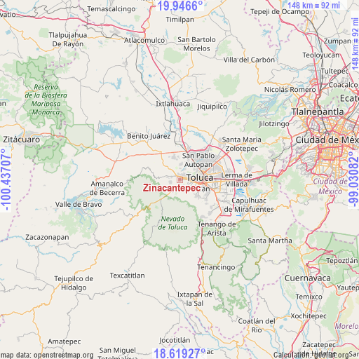
Zinacantepec GPS coordinates[2]
19° 17' 3.408" North, 99° 44' 2.184" West
| Map corner | latitude | longitude |
|---|---|---|
| Upper-left | 19.9466°, | -100.43707° |
| Center: | 19.28428°, | -99.73394° |
| Lower-right: | 18.61927°, | -99.03082° |
| Map W x H: | 147.6×147.6 km | = 91.7×91.7mi |
| max Lat: | 32.7° ⇑59.1% North |
| Zinacantepec: | 19.28428° |
| min Lat: | ⇓40.9% South 14.53588° |
| min Long | Zinacantepec | max Long |
| -117.105° | -99.73394° | -86.73105° |
| W 39.4%⇐ | ⇒60.6% E |
Elevation
Elevation of Zinacantepec is 2754 m = 9035 ft, and this is 1500.3 m = 4922 ft above average elevation for this country.
| Max E: |
3497 m = 11473 ft | 1.9% |
| Zinacantepec | 2754 m 9035 ft | |
| Avg. | 1253.7 m = 4113 ft | |
Min E: |
-1 m = -3 ft | 98.1% |
See also: Zinacantepec elevation on elevation.city.
Geographical zone
Zinacantepec is located in North Torrid zone (between Equator and Tropic of Cancer). Distance of this Northern Tropic circle is 461.7 km =286.9 mi to North.| Distance of | km | miles | from Zinacantepec |
|---|---|---|---|
| North Pole | 7862.9 | 4885.8 | to North |
| Arctic Circle | 5257 | 3266.5 | to North |
| Tropic Cancer | 461.7 | 286.9 | to North |
| Equator | 2144.2 | 1332.3 | to South |


Nearby cities:
15 places around Zinacantepec: (largest is in red/bold)
• Besana Ancha
4 km =2.5 mi,  306°
306°
• Cacalomacan
4.5 km =2.8 mi,  139°
139°
• Cerro del Murciélago
2.2 km =1.4 mi,  263°
263°
• Colonia Morelos
4.4 km =2.7 mi,  196°
196°
• Colonia Ricardo Flores Magón
3.1 km =1.9 mi,  235°
235°
• Colonia la Virgen
2.3 km =1.4 mi,  20°
20°
• Ejido San Lorenzo Cuauhtenco
2.6 km =1.6 mi,  317°
317°
• El Porvenir I
3.7 km =2.3 mi,  8°
8°
• La Joya
2.8 km =1.7 mi,  251°
251°
• Los Rosales
2.8 km =1.7 mi,  122°
122°
• San Antonio Acahualco
4.1 km =2.5 mi, 253°
• San Antonio Buenavista
3.5 km =2.2 mi, 138°
• San Francisco Tlalcilalcalpan
3.7 km =2.3 mi,  288°
288°
• San José Barbabosa
1.7 km =1.1 mi, 122°
• Santa Cruz Cuauhtenco
3.9 km =2.4 mi,  173°
173°
Sources, notices
• [Note1] Compared only with cities in Mexico existing in our database
• [Src1] Map data: © OpenStreetMap contributors (CC-BY-SA)
• [Src2] Other city data from geonames.org with taken over terms of usage.
• [Src3] Geographical zone / Annual Mean Temperature by Robert A. Rohde @ Wikipedia
