Álvaro Obregón geodata
Álvaro Obregón (Durango) is a populated place; located in Mexico in America/Monterrey (GMT-6) time zone. With population of 1,359 people, there are 6399 cities with bigger population in this country. Compared to other cities in Mexico, 92.8% of cities are located further ↓South; 88.3% of cities are located further →East and 56.5% of cities have higher elevation than Álvaro Obregón. Note1


Álvaro Obregón GPS coordinates[2]
25° 30' 51.012" North, 103° 30' 18" West
| Map corner | latitude | longitude |
|---|---|---|
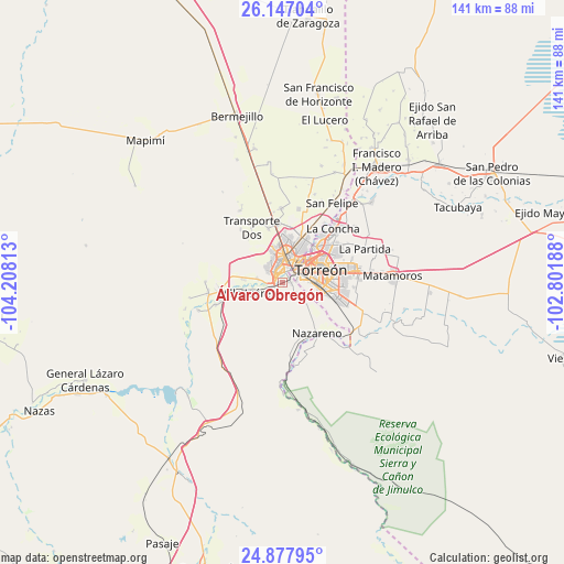
| Upper-left | 26.14704°, | -104.20813° |
| Center: | 25.51417°, | -103.505° |
| Lower-right: | 24.87795°, | -102.80188° |
| Map W x H: | 141.1×141.1 km | = 87.7×87.7mi |
| max Lat: | 32.7° ⇑7.2% North |
| Álvaro Obregón: | 25.51417° |
| min Lat: | ⇓92.8% South 14.53588° |
| min Long | Álvaro Obregó | max Long |
| -117.105° | -103.505° | -86.73105° |
| W 11.7%⇐ | ⇒88.3% E |
Elevation
Elevation of Álvaro Obregón is 1139 m = 3737 ft, and this is 114.7 m = 376 ft below average elevation for this country.
| Max E: |
3497 m = 11473 ft | 56.5% |
| Avg. | 1253.7 m = 4113 ft | |
| Álvaro Obregón | 1139 m = 3737 ft | |
Min E: |
-1 m = -3 ft | 43.5% |
See also: Mexico elevation on elevation.city.
Geographical zone
Álvaro Obregón is located in North temperate zone (between Tropic of Cancer and the Arctic Circle). Distance of this Northern Tropic circle is 231 km =143.5 mi to South.| Distance of | km | miles | from Álvaro Obregón |
|---|---|---|---|
| North Pole | 7170.2 | 4455.4 | to North |
| Arctic Circle | 4564.3 | 2836.1 | to North |
| Tropic Cancer | 231 | 143.5 | to South |
| Equator | 2836.9 | 1762.8 | to South |


Nearby cities:
15 places around Álvaro Obregón: (largest is in red/bold)
• Ciudad Lerdo
3.2 km =2 mi,  322°
322°
• Dolores (La Borrega)
9.8 km =6.1 mi,  332°
332°
• El Huarache (El Guarache)
2 km =1.2 mi,  70°
70°
• El Rayo
10.4 km =6.5 mi,  274°
274°
• Gómez Palacio
6.3 km =3.9 mi,  8°
8°
• Las Cuevas
4.8 km =3 mi,  248°
248°
• Las Isabeles
5.6 km =3.5 mi, 249°
• Las Piedras
7.7 km =4.8 mi,  259°
259°
• Los Angeles
6.3 km =3.9 mi,  277°
277°
• Monterrey
12.5 km =7.8 mi, 257°
• Nazas (Las Lagartijas)
13.7 km =8.5 mi,  19°
19°
• Seis de Enero
9.7 km =6 mi, 274°
• Torreón
9.2 km =5.7 mi, 69°
• Villa Juárez
9.3 km =5.8 mi, 254°
• Villa de Guadalupe
1.6 km =1 mi,  88°
88°
Sources, notices
• [Note1] Compared only with cities in Mexico existing in our database
• [Src1] Map data: © OpenStreetMap contributors (CC-BY-SA)
• [Src2] Other city data from geonames.org with taken over terms of usage.
• [Src3] Geographical zone / Annual Mean Temperature by Robert A. Rohde @ Wikipedia
