Tlahuico geodata
Tlahuico (State of Mexico) is a populated place; located in Mexico in America/Mexico_City (GMT-6) time zone. With population of 931 people, there are 9365 cities with bigger population in this country. Compared to other cities in Mexico, 50.4% of cities are located further ↑North; 54.3% of cities are located further ←West and 90.6% of cities have lower elevation than Tlahuico. Note1


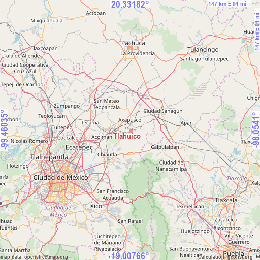
Tlahuico GPS coordinates[2]
19° 40' 15.996" North, 98° 45' 25.992" West
| Map corner | latitude | longitude |
|---|---|---|
| Upper-left | 20.33182°, | -99.46035° |
| Center: | 19.67111°, | -98.75722° |
| Lower-right: | 19.00766°, | -98.0541° |
| Map W x H: | 147.2×147.2 km | = 91.5×91.5mi |
| max Lat: | 32.7° ⇑50.4% North |
| Tlahuico: | 19.67111° |
| min Lat: | ⇓49.6% South 14.53588° |
| min Long | Tlahuico | max Long |
| -117.105° | -98.75722° | -86.73105° |
| W 54.3%⇐ | ⇒45.7% E |
Elevation
Elevation of Tlahuico is 2429 m = 7969 ft, and this is 1175.3 m = 3856 ft above average elevation for this country.
| Max E: |
3497 m = 11473 ft | 9.4% |
| Tlahuico | 2429 m 7969 ft | |
| Avg. | 1253.7 m = 4113 ft | |
Min E: |
-1 m = -3 ft | 90.6% |
See also: Mexico elevation on elevation.city.
Geographical zone
Tlahuico is located in North Torrid zone (between Equator and Tropic of Cancer). Distance of this Northern Tropic circle is 418.7 km =260.2 mi to North.| Distance of | km | miles | from Tlahuico |
|---|---|---|---|
| North Pole | 7819.8 | 4859 | to North |
| Arctic Circle | 5214 | 3239.8 | to North |
| Tropic Cancer | 418.7 | 260.2 | to North |
| Equator | 2187.2 | 1359.1 | to South |


Nearby cities:
15 places around Tlahuico: (largest is in red/bold)
• Axapusco
5.9 km =3.7 mi,  358°
358°
• Barrio San Antonio
7.2 km =4.5 mi,  0°
0°
• Barrio San Bartolo Alto
6.6 km =4.1 mi,  10°
10°
• Belem
5.9 km =3.7 mi,  224°
224°
• Colonia los Remedios
7.9 km =4.9 mi,  333°
333°
• Cuautlacingo
3.8 km =2.4 mi,  312°
312°
• Otumba
3.2 km =2 mi, 1°
• Oxtotipac
4.2 km =2.6 mi,  244°
244°
• San Francisco Tlaltica
2.3 km =1.4 mi,  232°
232°
• San Martín Ahuatepec
3.3 km =2.1 mi,  69°
69°
• San Pablo Ixquitlán
5.4 km =3.4 mi,  322°
322°
• Santiago Tepetitlán
7.4 km =4.6 mi, 240°
• Santiago Tolman
7.2 km =4.5 mi, 331°
• Tlalmimilolpan
0.9 km =0.6 mi, 3°
• Tlamapa
7.8 km =4.8 mi, 0°
Sources, notices
• [Note1] Compared only with cities in Mexico existing in our database
• [Src1] Map data: © OpenStreetMap contributors (CC-BY-SA)
• [Src2] Other city data from geonames.org with taken over terms of usage.
• [Src3] Geographical zone / Annual Mean Temperature by Robert A. Rohde @ Wikipedia
