San Francisco Yovego geodata
San Francisco Yovego (Oaxaca) is a populated place; located in Mexico in America/Mexico_City (GMT-6) time zone. With population of 902 people, there are 9667 cities with bigger population in this country. Compared to other cities in Mexico, 82.6% of cities are located further ↑North; 81.2% of cities are located further ←West and 65.3% of cities have higher elevation than San Francisco Yovego. Note1
Current local time in San Francisco Yovego:
08:33 AM, WednesdayDifference from your time zone: hours


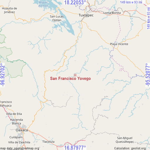
San Francisco Yovego GPS coordinates[2]
17° 33' 5.004" North, 96° 13' 26.004" West
| Map corner | latitude | longitude |
|---|---|---|
| Upper-left | 18.22053°, | -96.92702° |
| Center: | 17.55139°, | -96.22389° |
| Lower-right: | 16.87977°, | -95.52077° |
| Map W x H: | 149.1×149.1 km | = 92.6×92.6mi |
| max Lat: | 32.7° ⇑82.6% North |
| San Francisco Yovego: | 17.55139° |
| min Lat: | ⇓17.4% South 14.53588° |
| min Long | San Francisco Y | max Long |
| -117.105° | -96.22389° | -86.73105° |
| W 81.2%⇐ | ⇒18.8% E |
Elevation
Elevation of San Francisco Yovego is 669 m = 2195 ft, and this is 584.7 m = 1918 ft below average elevation for this country.
| Max E: |
3497 m = 11473 ft | 65.3% |
| Avg. | 1253.7 m = 4113 ft | |
| San Francisco Yovego | 669 m = 2195 ft | |
Min E: |
-1 m = -3 ft | 34.7% |
See also: Mexico elevation on elevation.city.
Geographical zone
San Francisco Yovego is located in North Torrid zone (between Equator and Tropic of Cancer). Distance of this Northern Tropic circle is 654.4 km =406.6 mi to North.| Distance of | km | miles | from San Francisco Yovego |
|---|---|---|---|
| North Pole | 8055.5 | 5005.5 | to North |
| Arctic Circle | 5449.6 | 3386.2 | to North |
| Tropic Cancer | 654.4 | 406.6 | to North |
| Equator | 1951.5 | 1212.6 | to South |


Nearby cities:
15 places around San Francisco Yovego: (largest is in red/bold)
• Asunción Lachixila
4.8 km =3 mi,  74°
74°
• Ayotzintepec
16.8 km =10.4 mi,  36°
36°
• La Josefina
14.6 km =9.1 mi, 36°
• San Juan Toavela
17.1 km =10.6 mi,  99°
99°
• San Juan Yaee
14.9 km =9.3 mi,  205°
205°
• San Juan Yatzona
17.6 km =10.9 mi,  160°
160°
• San Miguel Reagui
10.2 km =6.3 mi,  184°
184°
• San Pedro Ozumacín
14.1 km =8.8 mi,  359°
359°
• Santa Cruz Yagavila
16.4 km =10.2 mi,  219°
219°
• Santa María Lovani
15.8 km =9.8 mi, 104°
• Santa María Yaviche
18.3 km =11.4 mi,  204°
204°
• Santa María Zoogochi
18 km =11.2 mi, 222°
• Santiago Camotlán
12.5 km =7.8 mi, 160°
• Santiago Lalopa
15.1 km =9.4 mi,  190°
190°
• Santiago Teotlasco
15.6 km =9.7 mi, 221°
Sources, notices
• [Note1] Compared only with cities in Mexico existing in our database
• [Src1] Map data: © OpenStreetMap contributors (CC-BY-SA)
• [Src2] Other city data from geonames.org with taken over terms of usage.
• [Src3] Geographical zone / Annual Mean Temperature by Robert A. Rohde @ Wikipedia
