Miguel Hidalgo y Costilla geodata
Miguel Hidalgo y Costilla (Chiapas) is a populated place; located in Mexico in America/Mexico_City (GMT-6) time zone. With population of 837 people, there are 10451 cities with bigger population in this country. Compared to other cities in Mexico, 85.7% of cities are located further ↑North; 86.6% of cities are located further ←West and 71.8% of cities have higher elevation than Miguel Hidalgo y Costilla. Note1
Current local time in Miguel Hidalgo y Costilla:
08:33 AM, WednesdayDifference from your time zone: hours


Miguel Hidalgo y Costilla GPS coordinates[2]
17° 16' 5.988" North, 93° 26' 53.988" West
| Map corner | latitude | longitude |
|---|---|---|
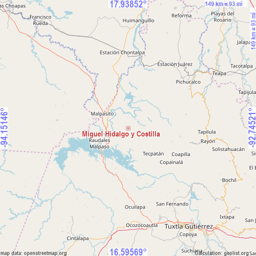
| Upper-left | 17.93852°, | -94.15146° |
| Center: | 17.26833°, | -93.44833° |
| Lower-right: | 16.59569°, | -92.74521° |
| Map W x H: | 149.3×149.3 km | = 92.8×92.8mi |
| max Lat: | 32.7° ⇑85.7% North |
| Miguel Hidalgo y Costilla: | 17.26833° |
| min Lat: | ⇓14.3% South 14.53588° |
| min Long | Miguel Hidalgo | max Long |
| -117.105° | -93.44833° | -86.73105° |
| W 86.6%⇐ | ⇒13.4% E |
Elevation
Elevation of Miguel Hidalgo y Costilla is 334 m = 1096 ft, and this is 919.7 m = 3017 ft below average elevation for this country.
| Max E: |
3497 m = 11473 ft | 71.8% |
| Avg. | 1253.7 m = 4113 ft | |
| Miguel Hidalgo y Costilla | 334 m = 1096 ft | |
Min E: |
-1 m = -3 ft | 28.2% |
See also: Mexico elevation on elevation.city.
Geographical zone
Miguel Hidalgo y Costilla is located in North Torrid zone (between Equator and Tropic of Cancer). Distance of this Northern Tropic circle is 685.9 km =426.2 mi to North.| Distance of | km | miles | from Miguel Hidalgo y Costilla |
|---|---|---|---|
| North Pole | 8087 | 5025 | to North |
| Arctic Circle | 5481.1 | 3405.8 | to North |
| Tropic Cancer | 685.9 | 426.2 | to North |
| Equator | 1920.1 | 1193.1 | to South |


Nearby cities:
15 places around Miguel Hidalgo y Costilla: (largest is in red/bold)
• Adolfo López Mateos
6.7 km =4.2 mi,  209°
209°
• Adolfo Ruiz Cortines
6.6 km =4.1 mi,  63°
63°
• Campamento General Emiliano Zapata
12.4 km =7.7 mi,  282°
282°
• El Porvenir
11.4 km =7.1 mi,  148°
148°
• El Progreso (Chintul)
14.6 km =9.1 mi,  257°
257°
• Emiliano Zapata
12.5 km =7.8 mi,  116°
116°
• Esperanza de los Pobres
6 km =3.7 mi,  321°
321°
• Francisco I. Madero
8.7 km =5.4 mi,  134°
134°
• Juan Sabines Gutiérrez
4.9 km =3 mi,  137°
137°
• Luis Espinoza
13.4 km =8.3 mi,  168°
168°
• Nuevo Naranjo
12.8 km =8 mi, 172°
• Rómulo Calzada (La Herradura)
13.8 km =8.6 mi,  306°
306°
• San José Maspac
14.9 km =9.3 mi,  77°
77°
• San Miguel la Sardina
10.6 km =6.6 mi,  74°
74°
• Santos Degollado
13.8 km =8.6 mi, 306°
Sources, notices
• [Note1] Compared only with cities in Mexico existing in our database
• [Src1] Map data: © OpenStreetMap contributors (CC-BY-SA)
• [Src2] Other city data from geonames.org with taken over terms of usage.
• [Src3] Geographical zone / Annual Mean Temperature by Robert A. Rohde @ Wikipedia
