San José Maspac geodata
San José Maspac (Chiapas) is a populated place; located in Mexico in America/Mexico_City (GMT-6) time zone. With population of 764 people, there are 11465 cities with bigger population in this country. Compared to other cities in Mexico, 85.3% of cities are located further ↑North; 87.1% of cities are located further ←West and 68.4% of cities have higher elevation than San José Maspac. Note1


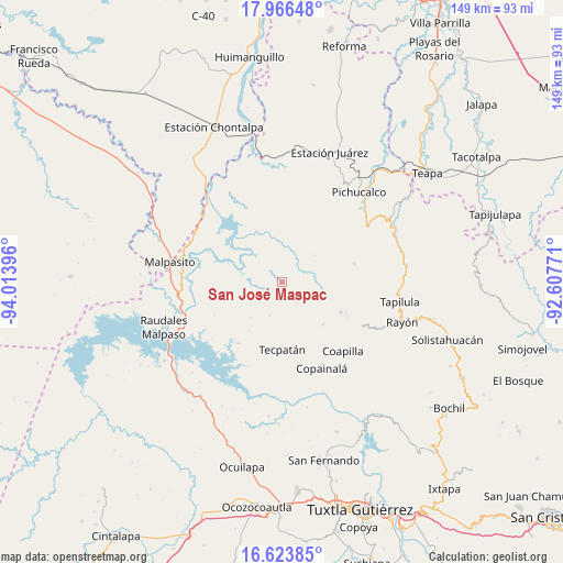
San José Maspac GPS coordinates[2]
17° 17' 47.004" North, 93° 18' 38.988" West
| Map corner | latitude | longitude |
|---|---|---|
| Upper-left | 17.96648°, | -94.01396° |
| Center: | 17.29639°, | -93.31083° |
| Lower-right: | 16.62385°, | -92.60771° |
| Map W x H: | 149.3×149.3 km | = 92.8×92.8mi |
| max Lat: | 32.7° ⇑85.3% North |
| San José Maspac: | 17.29639° |
| min Lat: | ⇓14.7% South 14.53588° |
| min Long | San José Maspa | max Long |
| -117.105° | -93.31083° | -86.73105° |
| W 87.1%⇐ | ⇒12.9% E |
Elevation
Elevation of San José Maspac is 504 m = 1654 ft, and this is 749.7 m = 2460 ft below average elevation for this country.
| Max E: |
3497 m = 11473 ft | 68.4% |
| Avg. | 1253.7 m = 4113 ft | |
| San José Maspac | 504 m = 1654 ft | |
Min E: |
-1 m = -3 ft | 31.6% |
See also: Mexico elevation on elevation.city.
Geographical zone
San José Maspac is located in North Torrid zone (between Equator and Tropic of Cancer). Distance of this Northern Tropic circle is 682.7 km =424.2 mi to North.| Distance of | km | miles | from San José Maspac |
|---|---|---|---|
| North Pole | 8083.9 | 5023.1 | to North |
| Arctic Circle | 5478 | 3403.9 | to North |
| Tropic Cancer | 682.7 | 424.2 | to North |
| Equator | 1923.2 | 1195 | to South |


Nearby cities:
15 places around San José Maspac: (largest is in red/bold)
• Adolfo Ruiz Cortines
8.6 km =5.3 mi,  268°
268°
• Campeche
13.4 km =8.3 mi,  163°
163°
• El Porvenir
15.5 km =9.6 mi,  213°
213°
• Emiliano Zapata
9.4 km =5.8 mi,  201°
201°
• Francisco I. Madero
12.5 km =7.8 mi,  222°
222°
• Juan Sabines Gutiérrez
13.2 km =8.2 mi,  239°
239°
• Miguel Hidalgo y Costilla
14.9 km =9.3 mi,  257°
257°
• Naranjo
9.5 km =5.9 mi,  95°
95°
• Ostuacán
12.6 km =7.8 mi,  347°
347°
• Rivera el Viejo Carmen
4.1 km =2.5 mi,  107°
107°
• San Antonio Poyono
14.7 km =9.1 mi,  127°
127°
• San Miguel la Sardina
4.4 km =2.7 mi, 266°
• San Pablo Huacano
15.7 km =9.8 mi,  135°
135°
• Vicente Guerrero
10.8 km =6.7 mi,  93°
93°
• Xochimilco (Reymundo Enríquez)
10.3 km =6.4 mi,  4°
4°
Sources, notices
• [Note1] Compared only with cities in Mexico existing in our database
• [Src1] Map data: © OpenStreetMap contributors (CC-BY-SA)
• [Src2] Other city data from geonames.org with taken over terms of usage.
• [Src3] Geographical zone / Annual Mean Temperature by Robert A. Rohde @ Wikipedia
