Ejido la Palma (La Palma) geodata
Ejido la Palma (La Palma) (State of Mexico) is a populated place; located in Mexico in America/Mexico_City (GMT-6) time zone. With population of 787 people, there are 11101 cities with bigger population in this country. Compared to other cities in Mexico, 53.4% of cities are located further ↓South; 62.3% of cities are located further →East and 95.8% of cities have lower elevation than Ejido la Palma (La Palma). Note1
Current local time in Ejido la Palma (La Palma):
10:07 AM, MondayDifference from your time zone: hours


Ejido la Palma (La Palma) GPS coordinates[2]
19° 49' 27.012" North, 99° 52' 9.984" West
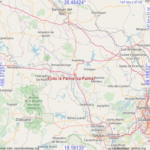
| Map corner | latitude | longitude |
|---|---|---|
| Upper-left | 20.48424°, | -100.57257° |
| Center: | 19.82417°, | -99.86944° |
| Lower-right: | 19.16135°, | -99.16632° |
| Map W x H: | 147.1×147.1 km | = 91.4×91.4mi |
| max Lat: | 32.7° ⇑46.6% North |
| Ejido la Palma (La Palma): | 19.82417° |
| min Lat: | ⇓53.4% South 14.53588° |
| min Long | Ejido la Palma | max Long |
| -117.105° | -99.86944° | -86.73105° |
| W 37.7%⇐ | ⇒62.3% E |
Elevation
Elevation of Ejido la Palma (La Palma) is 2619 m = 8593 ft, and this is 1365.3 m = 4479 ft above average elevation for this country.
| Max E: |
3497 m = 11473 ft | 4.2% |
| Ejido la Palma (La Palma) | 2619 m 8593 ft | |
| Avg. | 1253.7 m = 4113 ft | |
Min E: |
-1 m = -3 ft | 95.8% |
See also: Mexico elevation on elevation.city.
Geographical zone
Ejido la Palma (La Palma) is located in North Torrid zone (between Equator and Tropic of Cancer). Distance of this Northern Tropic circle is 401.7 km =249.6 mi to North.| Distance of | km | miles | from Ejido la Palma (La Palma) |
|---|---|---|---|
| North Pole | 7802.8 | 4848.4 | to North |
| Arctic Circle | 5196.9 | 3229.2 | to North |
| Tropic Cancer | 401.7 | 249.6 | to North |
| Equator | 2204.2 | 1369.6 | to South |


Nearby cities:
15 places around Ejido la Palma (La Palma): (largest is in red/bold)
• Atlacomulco de Fabela
2.8 km =1.7 mi,  191°
191°
• Colonia Río Lerma (Tic Ti)
3.6 km =2.2 mi,  234°
234°
• Dolores la Joya (La Joya)
4.1 km =2.5 mi,  106°
106°
• El Rincón de la Candelaria
4.7 km =2.9 mi,  144°
144°
• La Mesa de Chosto
3.8 km =2.4 mi,  325°
325°
• San Bartolo Lanzados
5.3 km =3.3 mi, 331°
• San Ignacio de Loyola
3.2 km =2 mi, 113°
• San José del Tunal
4.8 km =3 mi, 140°
• San Lorenzo Tlacotepec
4.7 km =2.9 mi,  253°
253°
• San Luis Boro
1.9 km =1.2 mi,  130°
130°
• San Pablo Atotonilco
5.8 km =3.6 mi,  122°
122°
• Santa Cruz Bombatevi
2.8 km =1.7 mi,  220°
220°
• Santo Domingo Shomege (Shomege)
4.1 km =2.5 mi,  304°
304°
• Tecoac (Santa María Nativitas)
4.3 km =2.7 mi,  156°
156°
• Tierras Blancas
5.2 km =3.2 mi,  9°
9°
Sources, notices
• [Note1] Compared only with cities in Mexico existing in our database
• [Src1] Map data: © OpenStreetMap contributors (CC-BY-SA)
• [Src2] Other city data from geonames.org with taken over terms of usage.
• [Src3] Geographical zone / Annual Mean Temperature by Robert A. Rohde @ Wikipedia
