San Lorenzo Tlacotepec geodata
San Lorenzo Tlacotepec (State of Mexico) is a populated place; located in Mexico in America/Mexico_City (GMT-6) time zone. With population of 7,566 people, there are 1233 cities with bigger population in this country. Compared to other cities in Mexico, 53.1% of cities are located further ↓South; 62.8% of cities are located further →East and 93.3% of cities have lower elevation than San Lorenzo Tlacotepec. Note1


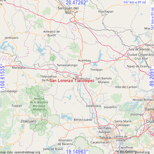
San Lorenzo Tlacotepec GPS coordinates[2]
19° 48' 45" North, 99° 54' 43.992" West
| Map corner | latitude | longitude |
|---|---|---|
| Upper-left | 20.47262°, | -100.61535° |
| Center: | 19.8125°, | -99.91222° |
| Lower-right: | 19.14963°, | -99.2091° |
| Map W x H: | 147.1×147.1 km | = 91.4×91.4mi |
| max Lat: | 32.7° ⇑46.9% North |
| San Lorenzo Tlacotepec: | 19.8125° |
| min Lat: | ⇓53.1% South 14.53588° |
| min Long | San Lorenzo Tla | max Long |
| -117.105° | -99.91222° | -86.73105° |
| W 37.2%⇐ | ⇒62.8% E |
Elevation
Elevation of San Lorenzo Tlacotepec is 2544 m = 8346 ft, and this is 1290.3 m = 4233 ft above average elevation for this country.
| Max E: |
3497 m = 11473 ft | 6.7% |
| San Lorenzo Tlacotepec | 2544 m 8346 ft | |
| Avg. | 1253.7 m = 4113 ft | |
Min E: |
-1 m = -3 ft | 93.3% |
See also: Mexico elevation on elevation.city.
Geographical zone
San Lorenzo Tlacotepec is located in North Torrid zone (between Equator and Tropic of Cancer). Distance of this Northern Tropic circle is 403 km =250.4 mi to North.| Distance of | km | miles | from San Lorenzo Tlacotepec |
|---|---|---|---|
| North Pole | 7804.1 | 4849.2 | to North |
| Arctic Circle | 5198.2 | 3230 | to North |
| Tropic Cancer | 403 | 250.4 | to North |
| Equator | 2202.9 | 1368.8 | to South |


Nearby cities:
15 places around San Lorenzo Tlacotepec: (largest is in red/bold)
• Atlacomulco de Fabela
4.2 km =2.6 mi,  110°
110°
• Chosto de los Jarros
5.7 km =3.5 mi,  2°
2°
• Colonia Río Lerma (Tic Ti)
1.7 km =1.1 mi,  116°
116°
• Concepción Caro
4.6 km =2.9 mi,  176°
176°
• Cuendo
4 km =2.5 mi,  249°
249°
• Ejido la Palma (La Palma)
4.7 km =2.9 mi,  73°
73°
• La Mesa de Chosto
5 km =3.1 mi,  27°
27°
• Manto del Río Ejido
3.4 km =2.1 mi,  332°
332°
• San Juan de los Jarros
5.5 km =3.4 mi,  355°
355°
• San Luis Boro
5.9 km =3.7 mi,  89°
89°
• San Miguel Tenochtitlán
5.9 km =3.7 mi,  190°
190°
• Santa Cruz Bombatevi
2.8 km =1.7 mi, 107°
• Santa María Citendejé
3.8 km =2.4 mi,  206°
206°
• Santiago Citendejé
3.9 km =2.4 mi, 207°
• Santo Domingo Shomege (Shomege)
3.8 km =2.4 mi,  16°
16°
Sources, notices
• [Note1] Compared only with cities in Mexico existing in our database
• [Src1] Map data: © OpenStreetMap contributors (CC-BY-SA)
• [Src2] Other city data from geonames.org with taken over terms of usage.
• [Src3] Geographical zone / Annual Mean Temperature by Robert A. Rohde @ Wikipedia
