Partido del Trabajo geodata
Partido del Trabajo (Baja California) is a populated place; located in Mexico in America/Tijuana (GMT-7) time zone. With population of 779 people, there are 11211 cities with bigger population in this country. Compared to other cities in Mexico, 99.7% of cities are located further ↓South; 99.8% of cities are located further →East and 75.9% of cities have higher elevation than Partido del Trabajo. Note1


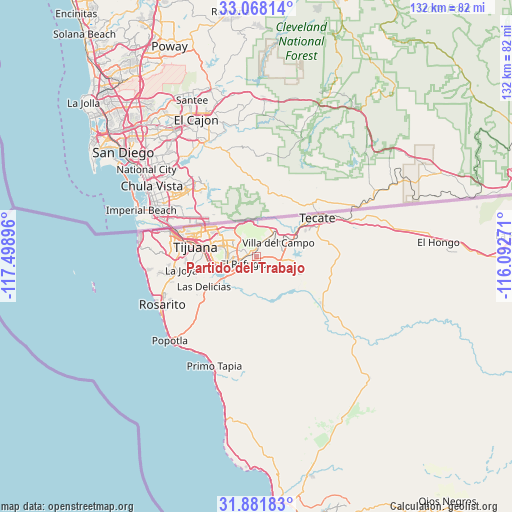
Partido del Trabajo GPS coordinates[2]
32° 28' 36.984" North, 116° 47' 44.988" West
| Map corner | latitude | longitude |
|---|---|---|
| Upper-left | 33.06814°, | -117.49896° |
| Center: | 32.47694°, | -116.79583° |
| Lower-right: | 31.88183°, | -116.09271° |
| Map W x H: | 131.9×131.9 km | = 82×82mi |
| max Lat: | 32.7° ⇑0.3% North |
| Partido del Trabajo: | 32.47694° |
| min Lat: | ⇓99.7% South 14.53588° |
| min Long | Partido del Tra | max Long |
| -117.105° | -116.79583° | -86.73105° |
| W 0.2%⇐ | ⇒99.8% E |
Elevation
Elevation of Partido del Trabajo is 192 m = 630 ft, and this is 1061.7 m = 3483 ft below average elevation for this country.
| Max E: |
3497 m = 11473 ft | 75.9% |
| Avg. | 1253.7 m = 4113 ft | |
| Partido del Trabajo | 192 m = 630 ft | |
Min E: |
-1 m = -3 ft | 24.1% |
See also: Mexico elevation on elevation.city.
Geographical zone
Partido del Trabajo is located in North temperate zone (between Tropic of Cancer and the Arctic Circle). Distance of this Northern Tropic circle is 1005.2 km =624.6 mi to South.| Distance of | km | miles | from Partido del Trabajo |
|---|---|---|---|
| North Pole | 6396 | 3974.3 | to North |
| Arctic Circle | 3790.1 | 2355.1 | to North |
| Tropic Cancer | 1005.2 | 624.6 | to South |
| Equator | 3611.1 | 2243.8 | to South |


Nearby cities:
15 places around Partido del Trabajo: (largest is in red/bold)
• Batalla Nacional
2.4 km =1.5 mi,  267°
267°
• Buenos Aires
14.9 km =9.3 mi,  246°
246°
• Ejido Javier Rojo Gómez
3.1 km =1.9 mi,  307°
307°
• Ejido Ojo de Agua
0.6 km =0.4 mi,  103°
103°
• El Niño
3.4 km =2.1 mi,  6°
6°
• Lomas de Santa Anita
15.4 km =9.6 mi,  61°
61°
• Lomas de Tlatelolco
0.9 km =0.6 mi,  321°
321°
• Lomas del Pedregal
1.3 km =0.8 mi, 6°
• Los Girasoles
1.9 km =1.2 mi,  112°
112°
• Maclovio Rojas
0.8 km =0.5 mi,  236°
236°
• Nuevo Progreso
1.8 km =1.1 mi,  134°
134°
• Terrazas del Valle
3.1 km =1.9 mi,  292°
292°
• Tres M (Pérez)
2.8 km =1.7 mi, 9°
• Valle Bonito
10 km =6.2 mi, 235°
• Villa del Campo
6.4 km =4 mi, 57°
Sources, notices
• [Note1] Compared only with cities in Mexico existing in our database
• [Src1] Map data: © OpenStreetMap contributors (CC-BY-SA)
• [Src2] Other city data from geonames.org with taken over terms of usage.
• [Src3] Geographical zone / Annual Mean Temperature by Robert A. Rohde @ Wikipedia
