Alitzé geodata
Alitzé (San Luis Potosí) is a populated place; located in Mexico in America/Mexico_City (GMT-6) time zone. With population of 750 people, there are 11679 cities with bigger population in this country. Compared to other cities in Mexico, 81.8% of cities are located further ↓South; 50.8% of cities are located further →East and 63.9% of cities have higher elevation than Alitzé. Note1


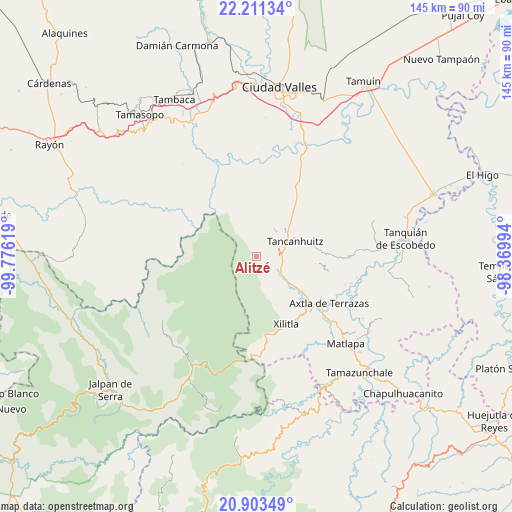
Alitzé GPS coordinates[2]
21° 33' 32.004" North, 99° 4' 23.016" West
| Map corner | latitude | longitude |
|---|---|---|
| Upper-left | 22.21134°, | -99.77619° |
| Center: | 21.55889°, | -99.07306° |
| Lower-right: | 20.90349°, | -98.36994° |
| Map W x H: | 145.4×145.4 km | = 90.3×90.3mi |
| max Lat: | 32.7° ⇑18.2% North |
| Alitzé: | 21.55889° |
| min Lat: | ⇓81.8% South 14.53588° |
| min Long | Alitzé | max Long |
| -117.105° | -99.07306° | -86.73105° |
| W 49.2%⇐ | ⇒50.8% E |
Elevation
Elevation of Alitzé is 757 m = 2484 ft, and this is 496.7 m = 1630 ft below average elevation for this country.
| Max E: |
3497 m = 11473 ft | 63.9% |
| Avg. | 1253.7 m = 4113 ft | |
| Alitzé | 757 m = 2484 ft | |
Min E: |
-1 m = -3 ft | 36.1% |
See also: Mexico elevation on elevation.city.
Geographical zone
Alitzé is located in North Torrid zone (between Equator and Tropic of Cancer). Distance of this Northern Tropic circle is 208.8 km =129.7 mi to North.| Distance of | km | miles | from Alitzé |
|---|---|---|---|
| North Pole | 7609.9 | 4728.6 | to North |
| Arctic Circle | 5004.1 | 3109.4 | to North |
| Tropic Cancer | 208.8 | 129.7 | to North |
| Equator | 2397.1 | 1489.5 | to South |


Nearby cities:
15 places around Alitzé: (largest is in red/bold)
• Agua Amarga
3.1 km =1.9 mi,  240°
240°
• Barrio la Cruz
4.7 km =2.9 mi,  157°
157°
• Cruz Blanca
7.5 km =4.7 mi,  105°
105°
• Jol Mom
2.9 km =1.8 mi,  129°
129°
• La Pimienta
7.6 km =4.7 mi,  116°
116°
• Mantezulel
7.8 km =4.8 mi,  12°
12°
• Múhuatl
0.9 km =0.6 mi,  201°
201°
• Octujub o Campeche
2.4 km =1.5 mi,  271°
271°
• San Isidro
5.2 km =3.2 mi,  138°
138°
• San Rafael Tamápatz
7.6 km =4.7 mi,  323°
323°
• Santa Bárbara
6.8 km =4.2 mi,  80°
80°
• Tamcuem
2.4 km =1.5 mi,  192°
192°
• Tamcuime
8 km =5 mi,  53°
53°
• Tampajal
4.7 km =2.9 mi,  153°
153°
• Tamápatz
1 km =0.6 mi,  330°
330°
Sources, notices
• [Note1] Compared only with cities in Mexico existing in our database
• [Src1] Map data: © OpenStreetMap contributors (CC-BY-SA)
• [Src2] Other city data from geonames.org with taken over terms of usage.
• [Src3] Geographical zone / Annual Mean Temperature by Robert A. Rohde @ Wikipedia
