Coxcoapan geodata
Coxcoapan (Veracruz) is a populated place; located in Mexico in America/Mexico_City (GMT-6) time zone. With population of 690 people, there are 12606 cities with bigger population in this country. Compared to other cities in Mexico, 72.8% of cities are located further ↑North; 84.6% of cities are located further ←West and 91.2% of cities have higher elevation than Coxcoapan. Note1


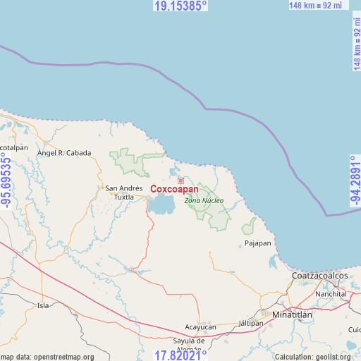
Coxcoapan GPS coordinates[2]
18° 29' 17.988" North, 94° 59' 31.992" West
| Map corner | latitude | longitude |
|---|---|---|
| Upper-left | 19.15385°, | -95.69535° |
| Center: | 18.48833°, | -94.99222° |
| Lower-right: | 17.82021°, | -94.2891° |
| Map W x H: | 148.3×148.3 km | = 92.1×92.1mi |
| max Lat: | 32.7° ⇑72.8% North |
| Coxcoapan: | 18.48833° |
| min Lat: | ⇓27.2% South 14.53588° |
| min Long | Coxcoapan | max Long |
| -117.105° | -94.99222° | -86.73105° |
| W 84.6%⇐ | ⇒15.4% E |
Elevation
Elevation of Coxcoapan is 21 m = 69 ft, and this is 1232.7 m = 4044 ft below average elevation for this country.
| Max E: |
3497 m = 11473 ft | 91.2% |
| Avg. | 1253.7 m = 4113 ft | |
| Coxcoapan | 21 m = 69 ft | |
Min E: |
-1 m = -3 ft | 8.8% |
See also: Mexico elevation on elevation.city.
Geographical zone
Coxcoapan is located in North Torrid zone (between Equator and Tropic of Cancer). Distance of this Northern Tropic circle is 550.2 km =341.9 mi to North.| Distance of | km | miles | from Coxcoapan |
|---|---|---|---|
| North Pole | 7951.4 | 4940.8 | to North |
| Arctic Circle | 5345.5 | 3321.5 | to North |
| Tropic Cancer | 550.2 | 341.9 | to North |
| Equator | 2055.7 | 1277.4 | to South |


Nearby cities:
15 places around Coxcoapan: (largest is in red/bold)
• Balzapote
16.7 km =10.4 mi,  329°
329°
• Bezuapan
19.5 km =12.1 mi,  243°
243°
• Catemaco
14.8 km =9.2 mi, 239°
• Colonia la Magdalena
17.4 km =10.8 mi,  180°
180°
• Dos Amates
7.2 km =4.5 mi,  273°
273°
• La Palma
10.9 km =6.8 mi,  316°
316°
• La Victoria
18.6 km =11.6 mi,  227°
227°
• Los Arrecifes
15.2 km =9.4 mi,  70°
70°
• Mario Sauza
9.3 km =5.8 mi,  292°
292°
• Matacapan
19.3 km =12 mi,  251°
251°
• Maxacapan
17.7 km =11 mi, 231°
• Pozolapan (Cartagena)
17.7 km =11 mi,  217°
217°
• Santa Rosa Abata
18.7 km =11.6 mi,  260°
260°
• Sontecomapan
4.8 km =3 mi, 289°
• Tebanca
10.1 km =6.3 mi,  193°
193°
Sources, notices
• [Note1] Compared only with cities in Mexico existing in our database
• [Src1] Map data: © OpenStreetMap contributors (CC-BY-SA)
• [Src2] Other city data from geonames.org with taken over terms of usage.
• [Src3] Geographical zone / Annual Mean Temperature by Robert A. Rohde @ Wikipedia
