General A. Tejeda y su A. Graciano Sánchez geodata
General A. Tejeda y su A. Graciano Sánchez (Veracruz) is a populated place; located in Mexico in America/Mexico_City (GMT-6) time zone. With population of 663 people, there are 13102 cities with bigger population in this country. Compared to other cities in Mexico, 75.9% of cities are located further ↓South; 67.2% of cities are located further ←West and 85.9% of cities have higher elevation than General A. Tejeda y su A. Graciano Sánchez. Note1
Current local time in General A. Tejeda y su A. Graciano Sánchez:
09:51 PM, TuesdayDifference from your time zone: hours


General A. Tejeda y su A. Graciano Sánchez GPS coordinates[2]
20° 57' 28.008" North, 97° 42' 23.004" West
| Map corner | latitude | longitude |
|---|---|---|
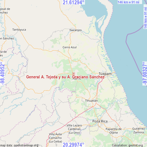
| Upper-left | 21.61294°, | -98.40952° |
| Center: | 20.95778°, | -97.70639° |
| Lower-right: | 20.29974°, | -97.00327° |
| Map W x H: | 146×146 km | = 90.7×90.7mi |
| max Lat: | 32.7° ⇑24.1% North |
| General A. Tejeda y su A. Graciano Sánchez: | 20.95778° |
| min Lat: | ⇓75.9% South 14.53588° |
| min Long | General A. Teje | max Long |
| -117.105° | -97.70639° | -86.73105° |
| W 67.2%⇐ | ⇒32.8% E |
Elevation
Elevation of General A. Tejeda y su A. Graciano Sánchez is 39 m = 128 ft, and this is 1214.7 m = 3985 ft below average elevation for this country.
| Max E: |
3497 m = 11473 ft | 85.9% |
| Avg. | 1253.7 m = 4113 ft | |
| General A. Tejeda y su A. Graciano Sánchez | 39 m = 128 ft | |
Min E: |
-1 m = -3 ft | 14.1% |
See also: Mexico elevation on elevation.city.
Geographical zone
General A. Tejeda y su A. Graciano Sánchez is located in North Torrid zone (between Equator and Tropic of Cancer). Distance of this Northern Tropic circle is 275.6 km =171.2 mi to North.| Distance of | km | miles | from General A. Tejeda y su A. Graciano Sánchez |
|---|---|---|---|
| North Pole | 7676.8 | 4770.1 | to North |
| Arctic Circle | 5070.9 | 3150.9 | to North |
| Tropic Cancer | 275.6 | 171.2 | to North |
| Equator | 2330.3 | 1448 | to South |


Nearby cities:
15 places around General A. Tejeda y su A. Graciano Sánchez: (largest is in red/bold)
• Agua Nacida
4.8 km =3 mi,  180°
180°
• Chapopote Núñez
3.8 km =2.4 mi,  139°
139°
• Estación Chapapote (Puerta Siete)
2.1 km =1.3 mi,  236°
236°
• Jardín Viejo
7.6 km =4.7 mi,  132°
132°
• La Tortuga
5.3 km =3.3 mi,  164°
164°
• Las Flores Cinco Poblados
8.1 km =5 mi,  249°
249°
• Loma Bonita
3.7 km =2.3 mi, 125°
• Ojital Ciruelo
3.3 km =2.1 mi,  255°
255°
• Ojital Santa María
4.8 km =3 mi, 263°
• Palo Blanco
6.9 km =4.3 mi,  226°
226°
• Puerta Siete
1.7 km =1.1 mi, 163°
• Rodríguez Clara
8.2 km =5.1 mi,  198°
198°
• Tierra Blanca Booxter
4.3 km =2.7 mi,  345°
345°
• Vara Alta
5.4 km =3.4 mi,  37°
37°
• Álamo
6.1 km =3.8 mi,  148°
148°
Sources, notices
• [Note1] Compared only with cities in Mexico existing in our database
• [Src1] Map data: © OpenStreetMap contributors (CC-BY-SA)
• [Src2] Other city data from geonames.org with taken over terms of usage.
• [Src3] Geographical zone / Annual Mean Temperature by Robert A. Rohde @ Wikipedia
