Guadalupe del Río geodata
Guadalupe del Río (State of Mexico) is a populated place; located in Mexico in America/Mexico_City (GMT-6) time zone. With population of 624 people, there are 13853 cities with bigger population in this country. Compared to other cities in Mexico, 50.8% of cities are located further ↓South; 62.5% of cities are located further →East and 93% of cities have lower elevation than Guadalupe del Río. Note1


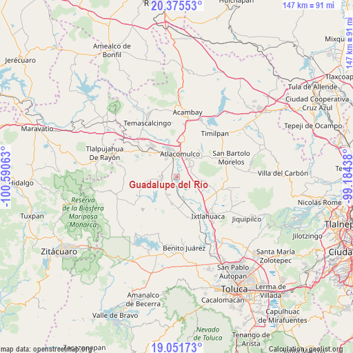
Guadalupe del Río GPS coordinates[2]
19° 42' 54" North, 99° 53' 15" West
| Map corner | latitude | longitude |
|---|---|---|
| Upper-left | 20.37553°, | -100.59063° |
| Center: | 19.715°, | -99.8875° |
| Lower-right: | 19.05173°, | -99.18438° |
| Map W x H: | 147.2×147.2 km | = 91.5×91.5mi |
| max Lat: | 32.7° ⇑49.2% North |
| Guadalupe del Río: | 19.715° |
| min Lat: | ⇓50.8% South 14.53588° |
| min Long | Guadalupe del R | max Long |
| -117.105° | -99.8875° | -86.73105° |
| W 37.5%⇐ | ⇒62.5% E |
Elevation
Elevation of Guadalupe del Río is 2528 m = 8294 ft, and this is 1274.3 m = 4181 ft above average elevation for this country.
| Max E: |
3497 m = 11473 ft | 7% |
| Guadalupe del Río | 2528 m 8294 ft | |
| Avg. | 1253.7 m = 4113 ft | |
Min E: |
-1 m = -3 ft | 93% |
See also: Mexico elevation on elevation.city.
Geographical zone
Guadalupe del Río is located in North Torrid zone (between Equator and Tropic of Cancer). Distance of this Northern Tropic circle is 413.8 km =257.1 mi to North.| Distance of | km | miles | from Guadalupe del Río |
|---|---|---|---|
| North Pole | 7815 | 4856 | to North |
| Arctic Circle | 5209.1 | 3236.8 | to North |
| Tropic Cancer | 413.8 | 257.1 | to North |
| Equator | 2192.1 | 1362.1 | to South |


Nearby cities:
15 places around Guadalupe del Río: (largest is in red/bold)
• Barrio el Ruso
6.2 km =3.9 mi,  92°
92°
• Concepción Caro
6.7 km =4.2 mi,  340°
340°
• Ejido de Atotonilco
4.2 km =2.6 mi,  113°
113°
• Ejido de San Juan Jalpa
3.6 km =2.2 mi,  223°
223°
• Ejido de la Concepción de los Baños Primero
3.7 km =2.3 mi,  125°
125°
• Ejido del Tunal Nenaxi
3.9 km =2.4 mi,  325°
325°
• Jalpa de los Baños
4.3 km =2.7 mi,  160°
160°
• La Cabecera Concepción
5.8 km =3.6 mi,  257°
257°
• La Concepción de los Baños
4.6 km =2.9 mi,  142°
142°
• La Loma de Endare
6.8 km =4.2 mi,  73°
73°
• Ojo de Agua
4.9 km =3 mi, 72°
• San Felipe del Progreso
6.7 km =4.2 mi,  269°
269°
• San Francisco del Río
2.6 km =1.6 mi,  194°
194°
• San Juan Jalpa Centro
4.8 km =3 mi,  247°
247°
• San Miguel Tenochtitlán
6.2 km =3.9 mi,  323°
323°
Sources, notices
• [Note1] Compared only with cities in Mexico existing in our database
• [Src1] Map data: © OpenStreetMap contributors (CC-BY-SA)
• [Src2] Other city data from geonames.org with taken over terms of usage.
• [Src3] Geographical zone / Annual Mean Temperature by Robert A. Rohde @ Wikipedia
