San Miguel Tenochtitlán geodata
San Miguel Tenochtitlán (State of Mexico) is a populated place; located in Mexico in America/Mexico_City (GMT-6) time zone. With population of 5,805 people, there are 1599 cities with bigger population in this country. Compared to other cities in Mexico, 51.7% of cities are located further ↓South; 62.9% of cities are located further →East and 94.6% of cities have lower elevation than San Miguel Tenochtitlán. Note1
Current local time in San Miguel Tenochtitlán:
10:01 AM, MondayDifference from your time zone: hours


San Miguel Tenochtitlán GPS coordinates[2]
19° 45' 37.008" North, 99° 55' 21" West
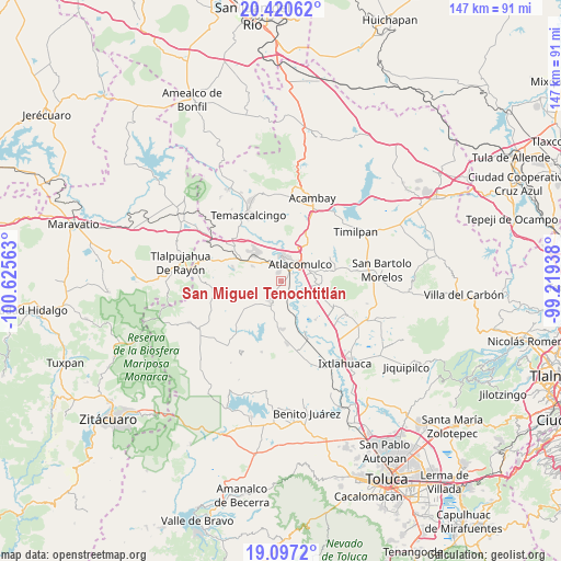
| Map corner | latitude | longitude |
|---|---|---|
| Upper-left | 20.42062°, | -100.62563° |
| Center: | 19.76028°, | -99.9225° |
| Lower-right: | 19.0972°, | -99.21938° |
| Map W x H: | 147.2×147.2 km | = 91.5×91.5mi |
| max Lat: | 32.7° ⇑48.3% North |
| San Miguel Tenochtitlán: | 19.76028° |
| min Lat: | ⇓51.7% South 14.53588° |
| min Long | San Miguel Teno | max Long |
| -117.105° | -99.9225° | -86.73105° |
| W 37.1%⇐ | ⇒62.9% E |
Elevation
Elevation of San Miguel Tenochtitlán is 2586 m = 8484 ft, and this is 1332.3 m = 4371 ft above average elevation for this country.
| Max E: |
3497 m = 11473 ft | 5.4% |
| San Miguel Tenochtitlán | 2586 m 8484 ft | |
| Avg. | 1253.7 m = 4113 ft | |
Min E: |
-1 m = -3 ft | 94.6% |
See also: Mexico elevation on elevation.city.
Geographical zone
San Miguel Tenochtitlán is located in North Torrid zone (between Equator and Tropic of Cancer). Distance of this Northern Tropic circle is 408.8 km =254 mi to North.| Distance of | km | miles | from San Miguel Tenochtitlán |
|---|---|---|---|
| North Pole | 7809.9 | 4852.8 | to North |
| Arctic Circle | 5204 | 3233.6 | to North |
| Tropic Cancer | 408.8 | 254 | to North |
| Equator | 2197.1 | 1365.2 | to South |


Nearby cities:
15 places around San Miguel Tenochtitlán: (largest is in red/bold)
• Atlacomulco de Fabela
6.6 km =4.1 mi,  48°
48°
• Colonia Río Lerma (Tic Ti)
5.7 km =3.5 mi,  27°
27°
• Concepción Caro
1.9 km =1.2 mi, 48°
• Cuendo
5.2 km =3.2 mi,  329°
329°
• Ejido del Tunal Nenaxi
2.3 km =1.4 mi,  141°
141°
• El Obraje
5.9 km =3.7 mi,  225°
225°
• Guadalupe del Río
6.2 km =3.9 mi, 143°
• La Cabecera Concepción
6.6 km =4.1 mi,  197°
197°
• San Felipe del Progreso
6 km =3.7 mi,  211°
211°
• San Juan Coajomulco
4.9 km =3 mi,  260°
260°
• San Lorenzo Tlacotepec
5.9 km =3.7 mi,  10°
10°
• Santa Cruz Bombatevi
6.2 km =3.9 mi,  37°
37°
• Santa María Citendejé
2.5 km =1.6 mi,  345°
345°
• Santiago Casandeje
5 km =3.1 mi,  282°
282°
• Santiago Citendejé
2.4 km =1.5 mi,  343°
343°
Sources, notices
• [Note1] Compared only with cities in Mexico existing in our database
• [Src1] Map data: © OpenStreetMap contributors (CC-BY-SA)
• [Src2] Other city data from geonames.org with taken over terms of usage.
• [Src3] Geographical zone / Annual Mean Temperature by Robert A. Rohde @ Wikipedia
