La Mancuerna geodata
La Mancuerna (Veracruz) is a populated place; located in Mexico in America/Mexico_City (GMT-6) time zone. With population of 620 people, there are 13925 cities with bigger population in this country. Compared to other cities in Mexico, 50.1% of cities are located further ↓South; 73.3% of cities are located further ←West and 82.7% of cities have lower elevation than La Mancuerna. Note1


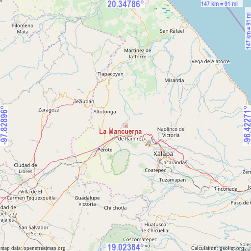
La Mancuerna GPS coordinates[2]
19° 41' 13.992" North, 97° 7' 32.988" West
| Map corner | latitude | longitude |
|---|---|---|
| Upper-left | 20.34786°, | -97.82896° |
| Center: | 19.68722°, | -97.12583° |
| Lower-right: | 19.02384°, | -96.42271° |
| Map W x H: | 147.2×147.2 km | = 91.5×91.5mi |
| max Lat: | 32.7° ⇑49.9% North |
| La Mancuerna: | 19.68722° |
| min Lat: | ⇓50.1% South 14.53588° |
| min Long | La Mancuerna | max Long |
| -117.105° | -97.12583° | -86.73105° |
| W 73.3%⇐ | ⇒26.7% E |
Elevation
Elevation of La Mancuerna is 2207 m = 7241 ft, and this is 953.3 m = 3128 ft above average elevation for this country.
| Max E: |
3497 m = 11473 ft | 17.3% |
| La Mancuerna | 2207 m 7241 ft | |
| Avg. | 1253.7 m = 4113 ft | |
Min E: |
-1 m = -3 ft | 82.7% |
See also: Mexico elevation on elevation.city.
Geographical zone
La Mancuerna is located in North Torrid zone (between Equator and Tropic of Cancer). Distance of this Northern Tropic circle is 416.9 km =259 mi to North.| Distance of | km | miles | from La Mancuerna |
|---|---|---|---|
| North Pole | 7818 | 4857.9 | to North |
| Arctic Circle | 5212.2 | 3238.7 | to North |
| Tropic Cancer | 416.9 | 259 | to North |
| Equator | 2189 | 1360.2 | to South |


Nearby cities:
15 places around La Mancuerna: (largest is in red/bold)
• Barrio de San Miguel
4.9 km =3 mi,  177°
177°
• Colonia Benito Juárez
8 km =5 mi,  203°
203°
• Colonia Libertad
9.2 km =5.7 mi,  263°
263°
• Cruz Blanca
7 km =4.3 mi,  217°
217°
• Gutiérrez Zamora
10.2 km =6.3 mi,  293°
293°
• Huichila
9 km =5.6 mi,  104°
104°
• Ignacio Zaragoza
10.7 km =6.6 mi,  284°
284°
• Juan Marcos (San José Buenavista)
8.8 km =5.5 mi,  302°
302°
• Las Minas
2.1 km =1.3 mi, 281°
• Las Vigas de Ramírez
6.3 km =3.9 mi,  152°
152°
• Mecacalco
9.6 km =6 mi,  6°
6°
• Río Vasco
8.4 km =5.2 mi,  4°
4°
• Tatatila
1.6 km =1 mi,  65°
65°
• Tiocuautla
7.6 km =4.7 mi,  17°
17°
• Toxtlacuaya
10.1 km =6.3 mi,  139°
139°
Sources, notices
• [Note1] Compared only with cities in Mexico existing in our database
• [Src1] Map data: © OpenStreetMap contributors (CC-BY-SA)
• [Src2] Other city data from geonames.org with taken over terms of usage.
• [Src3] Geographical zone / Annual Mean Temperature by Robert A. Rohde @ Wikipedia
