Mecacalco geodata
Mecacalco (Veracruz) is a populated place; located in Mexico in America/Mexico_City (GMT-6) time zone. With population of 511 people, there are 16451 cities with bigger population in this country. Compared to other cities in Mexico, 52% of cities are located further ↓South; 73.4% of cities are located further ←West and 59.5% of cities have higher elevation than Mecacalco. Note1


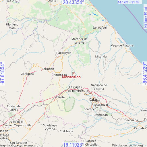
Mecacalco GPS coordinates[2]
19° 46' 23.736" North, 97° 6' 55.476" West
| Map corner | latitude | longitude |
|---|---|---|
| Upper-left | 20.43354°, | -97.81854° |
| Center: | 19.77326°, | -97.11541° |
| Lower-right: | 19.11023°, | -96.41229° |
| Map W x H: | 147.1×147.1 km | = 91.4×91.4mi |
| max Lat: | 32.7° ⇑48% North |
| Mecacalco: | 19.77326° |
| min Lat: | ⇓52% South 14.53588° |
| min Long | Mecacalco | max Long |
| -117.105° | -97.11541° | -86.73105° |
| W 73.4%⇐ | ⇒26.6% E |
Elevation
Elevation of Mecacalco is 1026 m = 3366 ft, and this is 227.7 m = 747 ft below average elevation for this country.
| Max E: |
3497 m = 11473 ft | 59.5% |
| Avg. | 1253.7 m = 4113 ft | |
| Mecacalco | 1026 m = 3366 ft | |
Min E: |
-1 m = -3 ft | 40.5% |
See also: Mexico elevation on elevation.city.
Geographical zone
Mecacalco is located in North Torrid zone (between Equator and Tropic of Cancer). Distance of this Northern Tropic circle is 407.3 km =253.1 mi to North.| Distance of | km | miles | from Mecacalco |
|---|---|---|---|
| North Pole | 7808.5 | 4852 | to North |
| Arctic Circle | 5202.6 | 3232.7 | to North |
| Tropic Cancer | 407.3 | 253.1 | to North |
| Equator | 2198.6 | 1366.1 | to South |


Nearby cities:
15 places around Mecacalco: (largest is in red/bold)
• Buena Vista
11.8 km =7.3 mi,  257°
257°
• Gutiérrez Zamora
11.8 km =7.3 mi,  242°
242°
• Ictzictic
9.2 km =5.7 mi,  280°
280°
• Juan Marcos (San José Buenavista)
9.8 km =6.1 mi, 240°
• La Mancuerna
9.6 km =6 mi,  186°
186°
• La Prensa
4.1 km =2.5 mi,  49°
49°
• Las Minas
9.7 km =6 mi,  199°
199°
• Las Truchas
3.4 km =2.1 mi,  66°
66°
• Mexcalteco
5.4 km =3.4 mi,  357°
357°
• Río Vasco
1.2 km =0.7 mi, 201°
• Tatatila
8.9 km =5.5 mi,  177°
177°
• Temimilco
4 km =2.5 mi,  31°
31°
• Tiocuautla
2.6 km =1.6 mi,  153°
153°
• Xoampolco
12 km =7.5 mi, 263°
• Zapotitlán
7.2 km =4.5 mi,  328°
328°
Sources, notices
• [Note1] Compared only with cities in Mexico existing in our database
• [Src1] Map data: © OpenStreetMap contributors (CC-BY-SA)
• [Src2] Other city data from geonames.org with taken over terms of usage.
• [Src3] Geographical zone / Annual Mean Temperature by Robert A. Rohde @ Wikipedia
