Valle Alto geodata
Valle Alto (Veracruz) is a populated place; located in Mexico in America/Mexico_City (GMT-6) time zone. With population of 614 people, there are 14035 cities with bigger population in this country. Compared to other cities in Mexico, 62.6% of cities are located further ↑North; 81.3% of cities are located further ←West and 89% of cities have higher elevation than Valle Alto. Note1


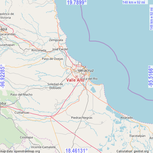
Valle Alto GPS coordinates[2]
19° 7' 36.984" North, 96° 13' 10.992" West
| Map corner | latitude | longitude |
|---|---|---|
| Upper-left | 19.7899°, | -96.92285° |
| Center: | 19.12694°, | -96.21972° |
| Lower-right: | 18.46131°, | -95.5166° |
| Map W x H: | 147.7×147.7 km | = 91.8×91.8mi |
| max Lat: | 32.7° ⇑62.6% North |
| Valle Alto: | 19.12694° |
| min Lat: | ⇓37.4% South 14.53588° |
| min Long | Valle Alto | max Long |
| -117.105° | -96.21972° | -86.73105° |
| W 81.3%⇐ | ⇒18.7% E |
Elevation
Elevation of Valle Alto is 27 m = 89 ft, and this is 1226.7 m = 4025 ft below average elevation for this country.
| Max E: |
3497 m = 11473 ft | 89% |
| Avg. | 1253.7 m = 4113 ft | |
| Valle Alto | 27 m = 89 ft | |
Min E: |
-1 m = -3 ft | 11% |
See also: Mexico elevation on elevation.city.
Geographical zone
Valle Alto is located in North Torrid zone (between Equator and Tropic of Cancer). Distance of this Northern Tropic circle is 479.2 km =297.8 mi to North.| Distance of | km | miles | from Valle Alto |
|---|---|---|---|
| North Pole | 7880.3 | 4896.6 | to North |
| Arctic Circle | 5274.5 | 3277.4 | to North |
| Tropic Cancer | 479.2 | 297.8 | to North |
| Equator | 2126.7 | 1321.5 | to South |


Nearby cities:
15 places around Valle Alto: (largest is in red/bold)
• Colina de los Pájaros
1.8 km =1.1 mi,  320°
320°
• Colonia Cardenista Antonio Luna
1.3 km =0.8 mi, 324°
• Colonia Malibrán
3 km =1.9 mi,  50°
50°
• Dos Lomas
3 km =1.9 mi, 317°
• Fraccionamiento Arboledas San Ramón
7.6 km =4.7 mi,  118°
118°
• Fraccionamiento Xana
5.6 km =3.5 mi, 47°
• Hacienda Sotavento
4.1 km =2.5 mi,  79°
79°
• Las Amapolas
3.6 km =2.2 mi,  39°
39°
• Lomas de Río Medio Cuatro
7.4 km =4.6 mi,  7°
7°
• Mata Loma
8 km =5 mi,  273°
273°
• Oasis
8.3 km =5.2 mi,  0°
0°
• Santa Rita
6.2 km =3.9 mi, 316°
• Sentimientos de la Nación
1.6 km =1 mi,  309°
309°
• Unidad Antorchista
2.1 km =1.3 mi,  304°
304°
• Valente Diaz
4.1 km =2.5 mi, 4°
Sources, notices
• [Note1] Compared only with cities in Mexico existing in our database
• [Src1] Map data: © OpenStreetMap contributors (CC-BY-SA)
• [Src2] Other city data from geonames.org with taken over terms of usage.
• [Src3] Geographical zone / Annual Mean Temperature by Robert A. Rohde @ Wikipedia
