Unidad Antorchista geodata
Unidad Antorchista (Veracruz) is a populated place; located in Mexico in America/Mexico_City (GMT-6) time zone. With population of 620 people, there are 13925 cities with bigger population in this country. Compared to other cities in Mexico, 62.4% of cities are located further ↑North; 81.1% of cities are located further ←West and 84.3% of cities have higher elevation than Unidad Antorchista. Note1


Unidad Antorchista GPS coordinates[2]
19° 8' 16.008" North, 96° 14' 9.996" West
| Map corner | latitude | longitude |
|---|---|---|
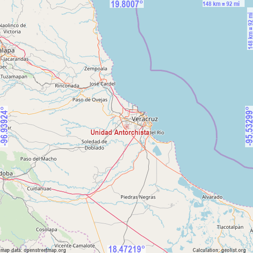
| Upper-left | 19.8007°, | -96.93924° |
| Center: | 19.13778°, | -96.23611° |
| Lower-right: | 18.47219°, | -95.53299° |
| Map W x H: | 147.7×147.7 km | = 91.8×91.8mi |
| max Lat: | 32.7° ⇑62.4% North |
| Unidad Antorchista: | 19.13778° |
| min Lat: | ⇓37.6% South 14.53588° |
| min Long | Unidad Antorchi | max Long |
| -117.105° | -96.23611° | -86.73105° |
| W 81.1%⇐ | ⇒18.9% E |
Elevation
Elevation of Unidad Antorchista is 49 m = 161 ft, and this is 1204.7 m = 3952 ft below average elevation for this country.
| Max E: |
3497 m = 11473 ft | 84.3% |
| Avg. | 1253.7 m = 4113 ft | |
| Unidad Antorchista | 49 m = 161 ft | |
Min E: |
-1 m = -3 ft | 15.7% |
See also: Mexico elevation on elevation.city.
Geographical zone
Unidad Antorchista is located in North Torrid zone (between Equator and Tropic of Cancer). Distance of this Northern Tropic circle is 478 km =297 mi to North.| Distance of | km | miles | from Unidad Antorchista |
|---|---|---|---|
| North Pole | 7879.1 | 4895.8 | to North |
| Arctic Circle | 5273.3 | 3276.7 | to North |
| Tropic Cancer | 478 | 297 | to North |
| Equator | 2127.9 | 1322.2 | to South |


Nearby cities:
15 places around Unidad Antorchista: (largest is in red/bold)
• Colina de los Pájaros
0.6 km =0.4 mi,  72°
72°
• Colonia Cardenista Antonio Luna
1 km =0.6 mi,  100°
100°
• Colonia Malibrán
4.1 km =2.5 mi,  80°
80°
• Dos Lomas
1.1 km =0.7 mi,  343°
343°
• Fraccionamiento Xana
6.4 km =4 mi, 66°
• Hacienda Sotavento
5.8 km =3.6 mi,  94°
94°
• Las Amapolas
4.3 km =2.7 mi, 68°
• Lomas de Río Medio Cuatro
6.7 km =4.2 mi,  23°
23°
• Los Torrentes
7.6 km =4.7 mi, 19°
• Mata Loma
6.3 km =3.9 mi,  263°
263°
• Oasis
7.3 km =4.5 mi,  14°
14°
• Santa Rita
4.1 km =2.5 mi,  322°
322°
• Sentimientos de la Nación
0.5 km =0.3 mi,  108°
108°
• Valente Diaz
3.5 km =2.2 mi,  35°
35°
• Valle Alto
2.1 km =1.3 mi,  124°
124°
Sources, notices
• [Note1] Compared only with cities in Mexico existing in our database
• [Src1] Map data: © OpenStreetMap contributors (CC-BY-SA)
• [Src2] Other city data from geonames.org with taken over terms of usage.
• [Src3] Geographical zone / Annual Mean Temperature by Robert A. Rohde @ Wikipedia
