Barrio la Galera (La Galera) geodata
Barrio la Galera (La Galera) (State of Mexico) is a populated place; located in Mexico in America/Mexico_City (GMT-6) time zone. With population of 576 people, there are 14877 cities with bigger population in this country. Compared to other cities in Mexico, 58.2% of cities are located further ↑North; 62.1% of cities are located further →East and 98.9% of cities have lower elevation than Barrio la Galera (La Galera). Note1
Current local time in Barrio la Galera (La Galera):
12:34 PM, MondayDifference from your time zone: hours


Barrio la Galera (La Galera) GPS coordinates[2]
19° 19' 33.996" North, 99° 51' 3.996" West
| Map corner | latitude | longitude |
|---|---|---|
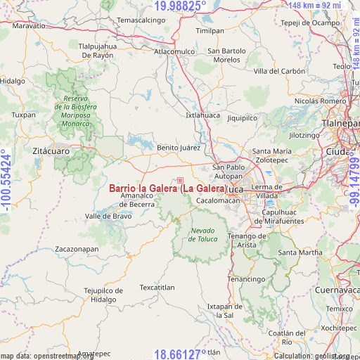
| Upper-left | 19.98825°, | -100.55424° |
| Center: | 19.32611°, | -99.85111° |
| Lower-right: | 18.66127°, | -99.14799° |
| Map W x H: | 147.5×147.5 km | = 91.7×91.7mi |
| max Lat: | 32.7° ⇑58.2% North |
| Barrio la Galera (La Galera): | 19.32611° |
| min Lat: | ⇓41.8% South 14.53588° |
| min Long | Barrio la Galer | max Long |
| -117.105° | -99.85111° | -86.73105° |
| W 37.9%⇐ | ⇒62.1% E |
Elevation
Elevation of Barrio la Galera (La Galera) is 2828 m = 9278 ft, and this is 1574.3 m = 5165 ft above average elevation for this country.
| Max E: |
3497 m = 11473 ft | 1.1% |
| Barrio la Galera (La Galera) | 2828 m 9278 ft | |
| Avg. | 1253.7 m = 4113 ft | |
Min E: |
-1 m = -3 ft | 98.9% |
See also: Mexico elevation on elevation.city.
Geographical zone
Barrio la Galera (La Galera) is located in North Torrid zone (between Equator and Tropic of Cancer). Distance of this Northern Tropic circle is 457.1 km =284 mi to North.| Distance of | km | miles | from Barrio la Galera (La Galera) |
|---|---|---|---|
| North Pole | 7858.2 | 4882.9 | to North |
| Arctic Circle | 5252.3 | 3263.6 | to North |
| Tropic Cancer | 457.1 | 284 | to North |
| Equator | 2148.9 | 1335.3 | to South |


Nearby cities:
15 places around Barrio la Galera (La Galera): (largest is in red/bold)
• Barrio de México
5.4 km =3.4 mi,  153°
153°
• Colonia Bellavista
5.4 km =3.4 mi,  124°
124°
• Ejido Tres Barrancas
5.9 km =3.7 mi,  79°
79°
• El Curtidor
4.2 km =2.6 mi,  156°
156°
• El Cóporo
5.1 km =3.2 mi, 160°
• Loma de Guadalupe
6.1 km =3.8 mi, 122°
• Loma de San Miguel
6.5 km =4 mi,  74°
74°
• Paredón Ejido
6.3 km =3.9 mi,  13°
13°
• San Antonio Buenavista
6.2 km =3.9 mi,  296°
296°
• San Bartolo del Llano (San Isidro)
3.4 km =2.1 mi,  133°
133°
• San Bartolo el Viejo
4.2 km =2.6 mi,  136°
136°
• San Miguel Almoloyan
6.3 km =3.9 mi,  59°
59°
• San Miguel Hojas Anchas
3.7 km =2.3 mi, 163°
• San Nicolás Amealco
2.1 km =1.3 mi,  269°
269°
• Santa María del Monte
5 km =3.1 mi, 144°
Sources, notices
• [Note1] Compared only with cities in Mexico existing in our database
• [Src1] Map data: © OpenStreetMap contributors (CC-BY-SA)
• [Src2] Other city data from geonames.org with taken over terms of usage.
• [Src3] Geographical zone / Annual Mean Temperature by Robert A. Rohde @ Wikipedia
