La Rondanilla (Primer Cuartel) geodata
La Rondanilla (Primer Cuartel) (Michoacán) is a populated place; located in Mexico in America/Mexico_City (GMT-6) time zone. With population of 566 people, there are 15096 cities with bigger population in this country. Compared to other cities in Mexico, 51.3% of cities are located further ↑North; 67.8% of cities are located further →East and 87.5% of cities have lower elevation than La Rondanilla (Primer Cuartel). Note1
Current local time in La Rondanilla (Primer Cuartel):
03:40 AM, WednesdayDifference from your time zone: hours


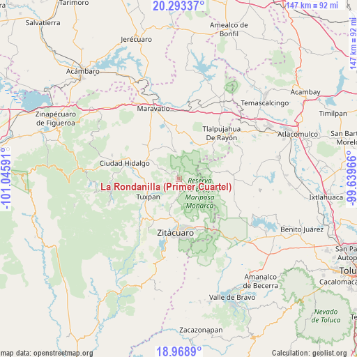
La Rondanilla (Primer Cuartel) GPS coordinates[2]
19° 37' 57" North, 100° 20' 34.008" West
| Map corner | latitude | longitude |
|---|---|---|
| Upper-left | 20.29337°, | -101.04591° |
| Center: | 19.6325°, | -100.34278° |
| Lower-right: | 18.9689°, | -99.63966° |
| Map W x H: | 147.3×147.3 km | = 91.5×91.5mi |
| max Lat: | 32.7° ⇑51.3% North |
| La Rondanilla (Primer Cuartel): | 19.6325° |
| min Lat: | ⇓48.7% South 14.53588° |
| min Long | La Rondanilla ( | max Long |
| -117.105° | -100.34278° | -86.73105° |
| W 32.2%⇐ | ⇒67.8% E |
Elevation
Elevation of La Rondanilla (Primer Cuartel) is 2326 m = 7631 ft, and this is 1072.3 m = 3518 ft above average elevation for this country.
| Max E: |
3497 m = 11473 ft | 12.5% |
| La Rondanilla (Primer Cuartel) | 2326 m 7631 ft | |
| Avg. | 1253.7 m = 4113 ft | |
Min E: |
-1 m = -3 ft | 87.5% |
See also: Mexico elevation on elevation.city.
Geographical zone
La Rondanilla (Primer Cuartel) is located in North Torrid zone (between Equator and Tropic of Cancer). Distance of this Northern Tropic circle is 423 km =262.8 mi to North.| Distance of | km | miles | from La Rondanilla (Primer Cuartel) |
|---|---|---|---|
| North Pole | 7824.1 | 4861.7 | to North |
| Arctic Circle | 5218.2 | 3242.4 | to North |
| Tropic Cancer | 423 | 262.8 | to North |
| Equator | 2182.9 | 1356.4 | to South |


Nearby cities:
15 places around La Rondanilla (Primer Cuartel): (largest is in red/bold)
• Aporo
8.3 km =5.2 mi,  300°
300°
• Cerro Prieto
7.3 km =4.5 mi,  132°
132°
• Cieneguillas
7.2 km =4.5 mi,  145°
145°
• Colonia Independencia
2.7 km =1.7 mi, 133°
• Cuartel la Mesa (El Asoleadero)
9.1 km =5.7 mi,  140°
140°
• El Paso
8.6 km =5.3 mi,  189°
189°
• El Soldado Anónimo
3.6 km =2.2 mi,  183°
183°
• Jesús de Nazareno (La Hacienda)
1.8 km =1.1 mi,  122°
122°
• La Salud
7.4 km =4.6 mi, 122°
• Manzana Rancho Escondido
8.8 km =5.5 mi, 125°
• Manzana de la Trinidad (La Junta)
4 km =2.5 mi, 125°
• Manzana el Mortero de San Cristóbal
7.5 km =4.7 mi, 182°
• Manzana la Cantera
7.8 km =4.8 mi, 132°
• Mineral de Angangueo
6.3 km =3.9 mi,  102°
102°
• Ocampo
5.6 km =3.5 mi, 176°
Sources, notices
• [Note1] Compared only with cities in Mexico existing in our database
• [Src1] Map data: © OpenStreetMap contributors (CC-BY-SA)
• [Src2] Other city data from geonames.org with taken over terms of usage.
• [Src3] Geographical zone / Annual Mean Temperature by Robert A. Rohde @ Wikipedia
