El Malacate geodata
El Malacate (Michoacán) is a populated place; located in Mexico in America/Mexico_City (GMT-6) time zone. With population of 909 people, there are 9599 cities with bigger population in this country. Compared to other cities in Mexico, 53.3% of cities are located further ↑North; 69.3% of cities are located further →East and 63.2% of cities have lower elevation than El Malacate. Note1


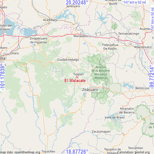
El Malacate GPS coordinates[2]
19° 32' 28.428" North, 100° 28' 30.936" West
| Map corner | latitude | longitude |
|---|---|---|
| Upper-left | 20.20248°, | -101.17839° |
| Center: | 19.54123°, | -100.47526° |
| Lower-right: | 18.87726°, | -99.77214° |
| Map W x H: | 147.4×147.4 km | = 91.6×91.6mi |
| max Lat: | 32.7° ⇑53.3% North |
| El Malacate: | 19.54123° |
| min Lat: | ⇓46.7% South 14.53588° |
| min Long | El Malacate | max Long |
| -117.105° | -100.47526° | -86.73105° |
| W 30.7%⇐ | ⇒69.3% E |
Elevation
Elevation of El Malacate is 1782 m = 5846 ft, and this is 528.3 m = 1733 ft above average elevation for this country.
| Max E: |
3497 m = 11473 ft | 36.8% |
| El Malacate | 1782 m 5846 ft | |
| Avg. | 1253.7 m = 4113 ft | |
Min E: |
-1 m = -3 ft | 63.2% |
See also: Mexico elevation on elevation.city.
Geographical zone
El Malacate is located in North Torrid zone (between Equator and Tropic of Cancer). Distance of this Northern Tropic circle is 433.1 km =269.1 mi to North.| Distance of | km | miles | from El Malacate |
|---|---|---|---|
| North Pole | 7834.3 | 4868 | to North |
| Arctic Circle | 5228.4 | 3248.8 | to North |
| Tropic Cancer | 433.1 | 269.1 | to North |
| Equator | 2172.8 | 1350.1 | to South |


Nearby cities:
15 places around El Malacate: (largest is in red/bold)
• Cerrito Colorado
3.1 km =1.9 mi,  291°
291°
• Cerrito del Muerto
6.1 km =3.8 mi,  172°
172°
• Cofradía de San José
5.4 km =3.4 mi,  24°
24°
• Colonia Puerto del Obispo
1.2 km =0.7 mi,  121°
121°
• La Garita
7.2 km =4.5 mi,  189°
189°
• La Presa (Segunda Manzana Barrio de Santa Cruz)
7.2 km =4.5 mi,  101°
101°
• La Soledad
2.4 km =1.5 mi,  200°
200°
• La Tinaja
7.4 km =4.6 mi, 189°
• Las Anonas
6.9 km =4.3 mi,  206°
206°
• Lázaro Cárdenas
5.8 km =3.6 mi, 191°
• Rincón de Corucha
4.5 km =2.8 mi,  90°
90°
• Santa Ana
4.6 km =2.9 mi,  8°
8°
• Santa Catarina
0.9 km =0.6 mi, 16°
• Tuxpan
3.3 km =2.1 mi,  25°
25°
• Zirahuato de los Bernal
7.5 km =4.7 mi,  107°
107°
Sources, notices
• [Note1] Compared only with cities in Mexico existing in our database
• [Src1] Map data: © OpenStreetMap contributors (CC-BY-SA)
• [Src2] Other city data from geonames.org with taken over terms of usage.
• [Src3] Geographical zone / Annual Mean Temperature by Robert A. Rohde @ Wikipedia
