La Tinaja geodata
La Tinaja (Michoacán) is a populated place; located in Mexico in America/Mexico_City (GMT-6) time zone. With population of 563 people, there are 15167 cities with bigger population in this country. Compared to other cities in Mexico, 54.6% of cities are located further ↑North; 69.4% of cities are located further →East and 50.8% of cities have lower elevation than La Tinaja. Note1


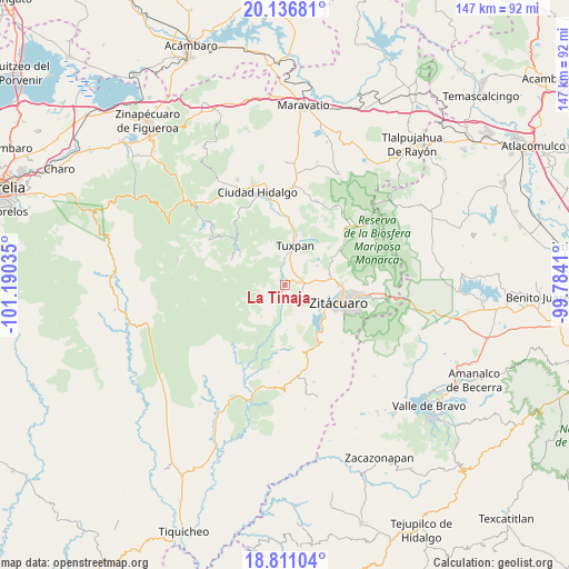
La Tinaja GPS coordinates[2]
19° 28' 31.008" North, 100° 29' 13.992" West
| Map corner | latitude | longitude |
|---|---|---|
| Upper-left | 20.13681°, | -101.19035° |
| Center: | 19.47528°, | -100.48722° |
| Lower-right: | 18.81104°, | -99.7841° |
| Map W x H: | 147.4×147.4 km | = 91.6×91.6mi |
| max Lat: | 32.7° ⇑54.6% North |
| La Tinaja: | 19.47528° |
| min Lat: | ⇓45.4% South 14.53588° |
| min Long | La Tinaja | max Long |
| -117.105° | -100.48722° | -86.73105° |
| W 30.6%⇐ | ⇒69.4% E |
Elevation
Elevation of La Tinaja is 1476 m = 4843 ft, and this is 222.3 m = 729 ft above average elevation for this country.
| Max E: |
3497 m = 11473 ft | 49.2% |
| La Tinaja | 1476 m 4843 ft | |
| Avg. | 1253.7 m = 4113 ft | |
Min E: |
-1 m = -3 ft | 50.8% |
See also: Mexico elevation on elevation.city.
Geographical zone
La Tinaja is located in North Torrid zone (between Equator and Tropic of Cancer). Distance of this Northern Tropic circle is 440.5 km =273.7 mi to North.| Distance of | km | miles | from La Tinaja |
|---|---|---|---|
| North Pole | 7841.6 | 4872.5 | to North |
| Arctic Circle | 5235.7 | 3253.3 | to North |
| Tropic Cancer | 440.5 | 273.7 | to North |
| Equator | 2165.4 | 1345.5 | to South |


Nearby cities:
15 places around La Tinaja: (largest is in red/bold)
• Agua Salada
5.1 km =3.2 mi,  113°
113°
• Cerrito Colorado
8.7 km =5.4 mi,  348°
348°
• Cerrito del Muerto
2.4 km =1.5 mi,  56°
56°
• Colonia Puerto del Obispo
7.1 km =4.4 mi,  18°
18°
• El Malacate
7.4 km =4.6 mi,  9°
9°
• El Mango
3.9 km =2.4 mi,  87°
87°
• Huanguitío
8.7 km =5.4 mi,  180°
180°
• Jungapeo de Juárez
2 km =1.2 mi,  203°
203°
• La Garita
0.2 km =0.1 mi, 6°
• La Soledad
5.1 km =3.2 mi,  4°
4°
• La Soledad
6 km =3.7 mi, 182°
• Las Anonas
2.2 km =1.4 mi,  301°
301°
• Lázaro Cárdenas
1.6 km =1 mi, 4°
• Ocurio
6.7 km =4.2 mi,  83°
83°
• Santa Catarina
8.4 km =5.2 mi, 10°
Sources, notices
• [Note1] Compared only with cities in Mexico existing in our database
• [Src1] Map data: © OpenStreetMap contributors (CC-BY-SA)
• [Src2] Other city data from geonames.org with taken over terms of usage.
• [Src3] Geographical zone / Annual Mean Temperature by Robert A. Rohde @ Wikipedia
