Valthe geodata
Valthe (Drenthe) is a populated place; located in Netherlands in Europe/Amsterdam (GMT+2) time zone. With population of 1,095 people, there are 1338 cities with bigger population in this country. Compared to other cities in Netherlands, 81.1% of cities are located further ↓South; 97% of cities are located further ←West and 83.5% of cities have lower elevation than Valthe. Note1


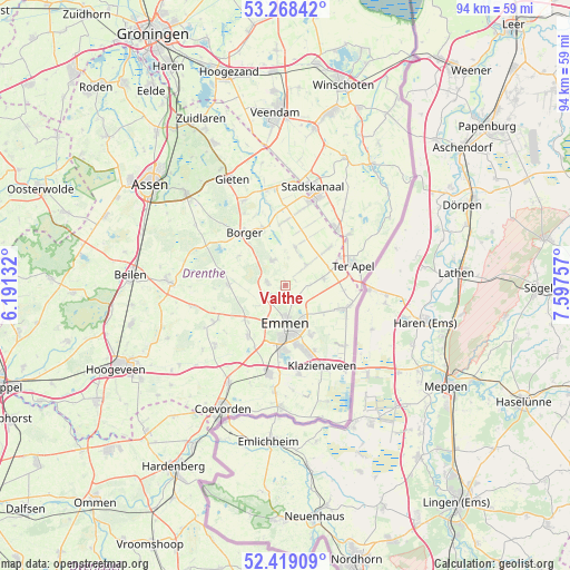
Valthe GPS coordinates[2]
52° 50' 44.988" North, 6° 53' 39.984" East
| Map corner | latitude | longitude |
|---|---|---|
| Upper-left | 53.26842°, | 6.19132° |
| Center: | 52.84583°, | 6.89444° |
| Lower-right: | 52.41909°, | 7.59757° |
| Map W x H: | 94.4×94.4 km | = 58.7×58.7mi |
| max Lat: | 53.48025° ⇑18.9% North |
| Valthe: | 52.84583° |
| min Lat: | ⇓81.1% South 50.76917° |
| min Long | Valthe | max Long |
| 3.38611° | 6.89444° | 7.16528° |
| W 97%⇐ | ⇒3% E |
Elevation
Elevation of Valthe is 25 m = 82 ft, and this is 10 m = 33 ft above average elevation for this country.
| Max E: |
203 m = 666 ft | 16.5% |
| Valthe | 25 m 82 ft | |
| Avg. | 15 m = 49 ft | |
Min E: |
-6 m = -20 ft | 83.5% |
See also: Netherlands elevation on elevation.city.
Geographical zone
Valthe is located in North temperate zone (between Tropic of Cancer and the Arctic Circle). Distance of this North polar circle is 1525.3 km =947.8 mi to North.| Distance of | km | miles | from Valthe |
|---|---|---|---|
| North Pole | 4131.2 | 2567 | to North |
| Arctic Circle | 1525.3 | 947.8 | to North |
| Tropic Cancer | 3270 | 2031.9 | to South |
| Equator | 5875.9 | 3651.1 | to South |


Nearby cities:
15 places around Valthe: (largest is in red/bold)
• Angelslo
7.5 km =4.7 mi,  163°
163°
• Bargeres
9.4 km =5.8 mi,  185°
185°
• Emmen
7.5 km =4.7 mi,  173°
173°
• Emmer-Erfscheidenveen
7.7 km =4.8 mi,  124°
124°
• Emmerhout
7.1 km =4.4 mi, 155°
• Emmermeer
5 km =3.1 mi,  180°
180°
• Emmerschans
5.8 km =3.6 mi,  149°
149°
• Exloo
4.6 km =2.9 mi,  333°
333°
• Klijndijk
2.8 km =1.7 mi,  235°
235°
• Noordbarge
8.2 km =5.1 mi, 183°
• Odoorn
2.9 km =1.8 mi,  277°
277°
• Schoonoord
9.3 km =5.8 mi,  270°
270°
• Tweede Exloërmond
7.5 km =4.7 mi,  20°
20°
• Valthermond
6.1 km =3.8 mi,  48°
48°
• Weerdinge
3.4 km =2.1 mi, 151°
Sources, notices
• [Note1] Compared only with cities in Netherlands existing in our database
• [Src1] Map data: © OpenStreetMap contributors (CC-BY-SA)
• [Src2] Other city data from geonames.org with taken over terms of usage.
• [Src3] Geographical zone / Annual Mean Temperature by Robert A. Rohde @ Wikipedia
