Valthermond geodata
Valthermond (Drenthe) is a populated place; located in Netherlands in Europe/Amsterdam (GMT+2) time zone. With population of 3,385 people, there are 700 cities with bigger population in this country. Compared to other cities in Netherlands, 82% of cities are located further ↓South; 98.4% of cities are located further ←West and 57.3% of cities have lower elevation than Valthermond. Note1


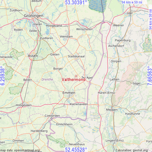
Valthermond GPS coordinates[2]
52° 52' 54.012" North, 6° 57' 45" East
| Map corner | latitude | longitude |
|---|---|---|
| Upper-left | 53.30391°, | 6.25938° |
| Center: | 52.88167°, | 6.9625° |
| Lower-right: | 52.45528°, | 7.66563° |
| Map W x H: | 94.4×94.4 km | = 58.7×58.7mi |
| max Lat: | 53.48025° ⇑18% North |
| Valthermond: | 52.88167° |
| min Lat: | ⇓82% South 50.76917° |
| min Long | Valthermond | max Long |
| 3.38611° | 6.9625° | 7.16528° |
| W 98.4%⇐ | ⇒1.6% E |
Elevation
Elevation of Valthermond is 9 m = 30 ft, and this is 6 m = 20 ft below average elevation for this country.
| Max E: |
203 m = 666 ft | 42.7% |
| Avg. | 15 m = 49 ft | |
| Valthermond | 9 m = 30 ft | |
Min E: |
-6 m = -20 ft | 57.3% |
See also: Netherlands elevation on elevation.city.
Geographical zone
Valthermond is located in North temperate zone (between Tropic of Cancer and the Arctic Circle). Distance of this North polar circle is 1521.3 km =945.3 mi to North.| Distance of | km | miles | from Valthermond |
|---|---|---|---|
| North Pole | 4127.2 | 2564.5 | to North |
| Arctic Circle | 1521.3 | 945.3 | to North |
| Tropic Cancer | 3274 | 2034.4 | to South |
| Equator | 5879.9 | 3653.6 | to South |


Nearby cities:
15 places around Valthermond: (largest is in red/bold)
• Ceresdorp
9.4 km =5.8 mi,  4°
4°
• Emmer-Compascuum
9.6 km =6 mi,  143°
143°
• Emmer-Erfscheidenveen
8.5 km =5.3 mi,  168°
168°
• Emmermeer
10.1 km =6.3 mi,  207°
207°
• Emmerschans
9.1 km =5.7 mi,  190°
190°
• Exloo
6.6 km =4.1 mi,  270°
270°
• Klijndijk
8.9 km =5.5 mi,  231°
231°
• Mussel
9.6 km =6 mi,  32°
32°
• Nieuw-Buinen
9 km =5.6 mi,  354°
354°
• Odoorn
8.3 km =5.2 mi,  244°
244°
• Ter Apel
6.5 km =4 mi,  94°
94°
• Ter Apelkanaal
6.2 km =3.9 mi,  68°
68°
• Tweede Exloërmond
3.6 km =2.2 mi,  327°
327°
• Valthe
6.1 km =3.8 mi, 228°
• Weerdinge
7.6 km =4.7 mi,  203°
203°
Sources, notices
• [Note1] Compared only with cities in Netherlands existing in our database
• [Src1] Map data: © OpenStreetMap contributors (CC-BY-SA)
• [Src2] Other city data from geonames.org with taken over terms of usage.
• [Src3] Geographical zone / Annual Mean Temperature by Robert A. Rohde @ Wikipedia
