Bong geodata
Bong (Limburg) is a populated place; located in Netherlands in Europe/Amsterdam (GMT+2) time zone. With population of 620 people, there are 1702 cities with bigger population in this country. Compared to other cities in Netherlands, 88.5% of cities are located further ↑North; 78.3% of cities are located further ←West and 82.9% of cities have lower elevation than Bong. Note1


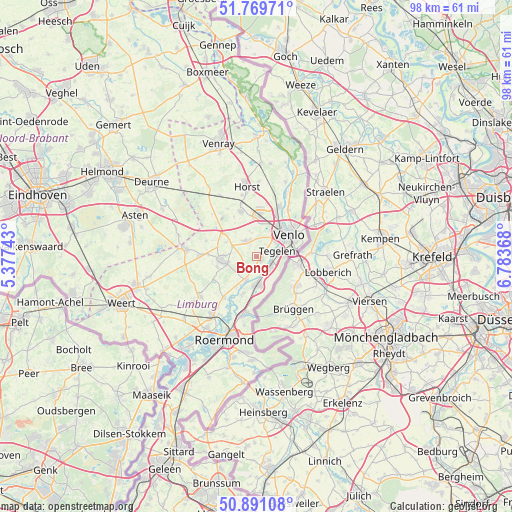
Bong GPS coordinates[2]
51° 19' 57" North, 6° 4' 50.016" East
| Map corner | latitude | longitude |
|---|---|---|
| Upper-left | 51.76971°, | 5.37743° |
| Center: | 51.3325°, | 6.08056° |
| Lower-right: | 50.89108°, | 6.78368° |
| Map W x H: | 97.7×97.7 km | = 60.7×60.7mi |
| max Lat: | 53.48025° ⇑88.5% North |
| Bong: | 51.3325° |
| min Lat: | ⇓11.5% South 50.76917° |
| min Long | Bong | max Long |
| 3.38611° | 6.08056° | 7.16528° |
| W 78.3%⇐ | ⇒21.7% E |
Elevation
Elevation of Bong is 24 m = 79 ft, and this is 9 m = 30 ft above average elevation for this country.
| Max E: |
203 m = 666 ft | 17.1% |
| Bong | 24 m 79 ft | |
| Avg. | 15 m = 49 ft | |
Min E: |
-6 m = -20 ft | 82.9% |
See also: Netherlands elevation on elevation.city.
Geographical zone
Bong is located in North temperate zone (between Tropic of Cancer and the Arctic Circle). Distance of this North polar circle is 1693.5 km =1052.3 mi to North.| Distance of | km | miles | from Bong |
|---|---|---|---|
| North Pole | 4299.4 | 2671.5 | to North |
| Arctic Circle | 1693.5 | 1052.3 | to North |
| Tropic Cancer | 3101.7 | 1927.3 | to South |
| Equator | 5707.6 | 3546.5 | to South |


Nearby cities:
15 places around Bong: (largest is in red/bold)
• Baarlo
1 km =0.6 mi,  100°
100°
• Beesel
7.7 km =4.8 mi,  202°
202°
• Beringe
9.2 km =5.7 mi,  272°
272°
• Boekend
5.7 km =3.5 mi,  26°
26°
• Egchel
7.8 km =4.8 mi,  254°
254°
• Helden
5.8 km =3.6 mi,  255°
255°
• Kessel
4.9 km =3 mi, 201°
• Kesseleik
7.2 km =4.5 mi,  213°
213°
• Koningslust
6.7 km =4.2 mi,  294°
294°
• Maasbree
3.6 km =2.2 mi,  321°
321°
• Offenbeek
5.7 km =3.5 mi,  169°
169°
• Panningen
7.1 km =4.4 mi, 264°
• Reuver
5.4 km =3.4 mi,  182°
182°
• Tegelen
4.1 km =2.5 mi,  71°
71°
• Venlo
7.4 km =4.6 mi,  55°
55°
Sources, notices
• [Note1] Compared only with cities in Netherlands existing in our database
• [Src1] Map data: © OpenStreetMap contributors (CC-BY-SA)
• [Src2] Other city data from geonames.org with taken over terms of usage.
• [Src3] Geographical zone / Annual Mean Temperature by Robert A. Rohde @ Wikipedia
