Panningen geodata
Panningen (Limburg) is a populated place; located in Netherlands in Europe/Amsterdam (GMT+2) time zone. With population of 6,710 people, there are 373 cities with bigger population in this country. Compared to other cities in Netherlands, 88.7% of cities are located further ↑North; 70.9% of cities are located further ←West and 90.9% of cities have lower elevation than Panningen. Note1


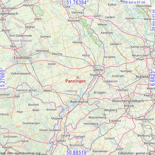
Panningen GPS coordinates[2]
51° 19' 36.012" North, 5° 58' 45.012" East
| Map corner | latitude | longitude |
|---|---|---|
| Upper-left | 51.76394°, | 5.27605° |
| Center: | 51.32667°, | 5.97917° |
| Lower-right: | 50.88519°, | 6.6823° |
| Map W x H: | 97.7×97.7 km | = 60.7×60.7mi |
| max Lat: | 53.48025° ⇑88.7% North |
| Panningen: | 51.32667° |
| min Lat: | ⇓11.3% South 50.76917° |
| min Long | Panningen | max Long |
| 3.38611° | 5.97917° | 7.16528° |
| W 70.9%⇐ | ⇒29.1% E |
Elevation
Elevation of Panningen is 35 m = 115 ft, and this is 20 m = 66 ft above average elevation for this country.
| Max E: |
203 m = 666 ft | 9.1% |
| Panningen | 35 m 115 ft | |
| Avg. | 15 m = 49 ft | |
Min E: |
-6 m = -20 ft | 90.9% |
See also: Netherlands elevation on elevation.city.
Geographical zone
Panningen is located in North temperate zone (between Tropic of Cancer and the Arctic Circle). Distance of this North polar circle is 1694.2 km =1052.7 mi to North.| Distance of | km | miles | from Panningen |
|---|---|---|---|
| North Pole | 4300.1 | 2672 | to North |
| Arctic Circle | 1694.2 | 1052.7 | to North |
| Tropic Cancer | 3101.1 | 1926.9 | to South |
| Equator | 5707 | 3546.2 | to South |


Nearby cities:
15 places around Panningen: (largest is in red/bold)
• Baarlo
8 km =5 mi,  86°
86°
• Beesel
7.7 km =4.8 mi,  147°
147°
• Beringe
2.4 km =1.5 mi,  297°
297°
• Bong
7.1 km =4.4 mi,  84°
84°
• Egchel
1.5 km =0.9 mi,  199°
199°
• Grashoek
4.6 km =2.9 mi,  326°
326°
• Helden
1.7 km =1.1 mi,  119°
119°
• Helenaveen
8.3 km =5.2 mi, 328°
• Kessel
6.5 km =4 mi,  126°
126°
• Kesseleik
6.2 km =3.9 mi, 150°
• Koningslust
3.6 km =2.2 mi,  15°
15°
• Maasbree
5.9 km =3.7 mi,  54°
54°
• Meijel
6.8 km =4.2 mi,  286°
286°
• Neerkant
9.1 km =5.7 mi, 300°
• Reuver
8.3 km =5.2 mi, 124°
Sources, notices
• [Note1] Compared only with cities in Netherlands existing in our database
• [Src1] Map data: © OpenStreetMap contributors (CC-BY-SA)
• [Src2] Other city data from geonames.org with taken over terms of usage.
• [Src3] Geographical zone / Annual Mean Temperature by Robert A. Rohde @ Wikipedia
