Angeren geodata
Angeren (Gelderland) is a populated place; located in Netherlands in Europe/Amsterdam (GMT+2) time zone. With population of 2,275 people, there are 897 cities with bigger population in this country. Compared to other cities in Netherlands, 56.7% of cities are located further ↑North; 68.7% of cities are located further ←West and 59.4% of cities have lower elevation than Angeren. Note1


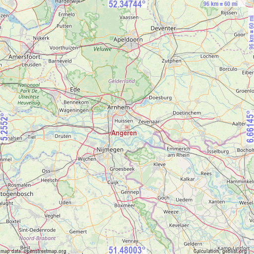
Angeren GPS coordinates[2]
51° 54' 56.988" North, 5° 57' 29.988" East
| Map corner | latitude | longitude |
|---|---|---|
| Upper-left | 52.34744°, | 5.2552° |
| Center: | 51.91583°, | 5.95833° |
| Lower-right: | 51.48003°, | 6.66145° |
| Map W x H: | 96.4×96.4 km | = 59.9×59.9mi |
| max Lat: | 53.48025° ⇑56.7% North |
| Angeren: | 51.91583° |
| min Lat: | ⇓43.3% South 50.76917° |
| min Long | Angeren | max Long |
| 3.38611° | 5.95833° | 7.16528° |
| W 68.7%⇐ | ⇒31.3% E |
Elevation
Elevation of Angeren is 10 m = 33 ft, and this is 5 m = 16 ft below average elevation for this country.
| Max E: |
203 m = 666 ft | 40.6% |
| Avg. | 15 m = 49 ft | |
| Angeren | 10 m = 33 ft | |
Min E: |
-6 m = -20 ft | 59.4% |
See also: Netherlands elevation on elevation.city.
Geographical zone
Angeren is located in North temperate zone (between Tropic of Cancer and the Arctic Circle). Distance of this North polar circle is 1628.7 km =1012 mi to North.| Distance of | km | miles | from Angeren |
|---|---|---|---|
| North Pole | 4234.6 | 2631.3 | to North |
| Arctic Circle | 1628.7 | 1012 | to North |
| Tropic Cancer | 3166.6 | 1967.6 | to South |
| Equator | 5772.5 | 3586.9 | to South |


Nearby cities:
15 places around Angeren: (largest is in red/bold)
• Bemmel
4.9 km =3 mi,  236°
236°
• Doornenburg
4.1 km =2.5 mi,  135°
135°
• Duiven
5.1 km =3.2 mi,  48°
48°
• Elden
7.1 km =4.4 mi,  312°
312°
• Gendt
4.3 km =2.7 mi,  168°
168°
• Groessen
5 km =3.1 mi,  69°
69°
• Haalderen
3.7 km =2.3 mi,  212°
212°
• Malburgen West
7.2 km =4.5 mi,  324°
324°
• Ooij
6.9 km =4.3 mi,  190°
190°
• Ooy
6.9 km =4.3 mi,  86°
86°
• Pannerden
6.2 km =3.9 mi,  116°
116°
• Stegeslag
7.7 km =4.8 mi, 68°
• Vredenburg
5.7 km =3.5 mi, 317°
• Westervoort
4.5 km =2.8 mi,  12°
12°
• Zonnemaat
7.3 km =4.5 mi,  76°
76°
Sources, notices
• [Note1] Compared only with cities in Netherlands existing in our database
• [Src1] Map data: © OpenStreetMap contributors (CC-BY-SA)
• [Src2] Other city data from geonames.org with taken over terms of usage.
• [Src3] Geographical zone / Annual Mean Temperature by Robert A. Rohde @ Wikipedia
