Al Mazyūnah geodata
Al Mazyūnah (Dhofar) is a seat of a second-order administrative division; located in Oman in Asia/Muscat (GMT+4) time zone. In our database, there are 31 cities with bigger population. Compared to other cities in Oman, 96.8% of cities are located further ↑North; 100% of cities are located further →East and 87.1% of cities have lower elevation than Al Mazyūnah. Note1


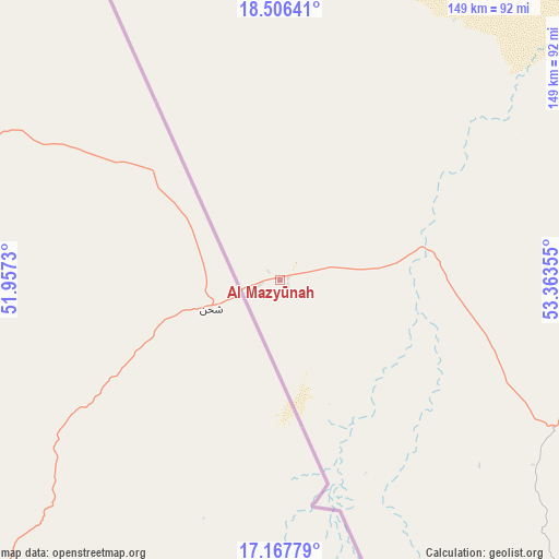
Al Mazyūnah GPS coordinates[2]
17° 50' 18.096" North, 52° 39' 37.512" East
| Map corner | latitude | longitude |
|---|---|---|
| Upper-left | 18.50641°, | 51.9573° |
| Center: | 17.83836°, | 52.66042° |
| Lower-right: | 17.16779°, | 53.36355° |
| Map W x H: | 148.8×148.8 km | = 92.5×92.5mi |
| max Lat: | 26.19778° ⇑96.8% North |
| Al Mazyūnah: | 17.83836° |
| min Lat: | ⇓3.2% South 17.01505° |
| min Long | Al Mazyūnah | max Long |
| 52.66042° | 52.66042° | 59.52889° |
| W 0%⇐ | ⇒100% E |
Elevation
Elevation of Al Mazyūnah is 504 m = 1654 ft, and this is 297.3 m = 975 ft above average elevation for this country.
| Max E: |
684 m = 2244 ft | 12.9% |
| Al Mazyūnah | 504 m 1654 ft | |
| Avg. | 206.7 m = 678 ft | |
Min E: |
1 m = 3 ft | 87.1% |
See also: Oman elevation on elevation.city.
Geographical zone
Al Mazyūnah is located in North Torrid zone (between Equator and Tropic of Cancer). Distance of this Northern Tropic circle is 622.5 km =386.8 mi to North.| Distance of | km | miles | from Al Mazyūnah |
|---|---|---|---|
| North Pole | 8023.6 | 4985.6 | to North |
| Arctic Circle | 5417.7 | 3366.4 | to North |
| Tropic Cancer | 622.5 | 386.8 | to North |
| Equator | 1983.4 | 1232.4 | to South |


Nearby cities:
1 places around Al Mazyūnah: (largest is in red/bold)
• Şalālah
177.4 km =110.2 mi,  121°
121°
Sources, notices
• [Note1] Compared only with cities in Oman existing in our database
• [Src1] Map data: © OpenStreetMap contributors (CC-BY-SA)
• [Src2] Other city data from geonames.org with taken over terms of usage.
• [Src3] Geographical zone / Annual Mean Temperature by Robert A. Rohde @ Wikipedia
