Morcolla geodata
Morcolla (Ayacucho) is a seat of a third-order administrative division; located in Peru in America/Lima (GMT-5) time zone. In our database, there are 305 cities with bigger population. Compared to other cities in Peru, 76.3% of cities are located further ↑North; 67.3% of cities are located further ←West and 78.6% of cities have lower elevation than Morcolla. Note1


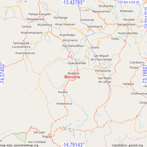
Morcolla GPS coordinates[2]
14° 6' 38.016" South, 73° 52' 17.004" West
| Map corner | latitude | longitude |
|---|---|---|
| Upper-left | -13.42765°, | -74.57452° |
| Center: | -14.11056°, | -73.87139° |
| Lower-right: | -14.79143°, | -73.16827° |
| Map W x H: | 151.6×151.6 km | = 94.2×94.2mi |
| max Lat: | -0.96667° ⇑76.3% North |
| Morcolla: | -14.11056° |
| min Lat: | ⇓23.7% South -18.01465° |
| min Long | Morcolla | max Long |
| -81.30472° | -73.87139° | -69.04167° |
| W 67.3%⇐ | ⇒32.7% E |
Elevation
Elevation of Morcolla is 3493 m = 11460 ft, and this is 1174.3 m = 3853 ft above average elevation for this country.
| Max E: |
5022 m = 16476 ft | 21.4% |
| Morcolla | 3493 m 11460 ft | |
| Avg. | 2318.7 m = 7607 ft | |
Min E: |
1 m = 3 ft | 78.6% |
See also: Peru elevation on elevation.city.
Geographical zone
Morcolla is located in South Torrid zone (between Equator and Tropic of Capricorn). Distance of this Southern Tropic circle is 1037 km =644.4 mi to South.| Distance of | km | miles | from Morcolla |
|---|---|---|---|
| Equator | 1568.9 | 974.9 | to North |
| Tropic Capricorn | 1037 | 644.4 | to South |
| Antarctic Circle | 5832.2 | 3624 | to South |
| South Pole | 8438.1 | 5243.2 | to South |


Nearby cities:
15 places around Morcolla: (largest is in red/bold)
• Andamarca
32.2 km =20 mi,  197°
197°
• Apongo
12.6 km =7.8 mi,  328°
328°
• Asquipata
7.5 km =4.7 mi, 326°
• Aucara
22 km =13.7 mi,  210°
210°
• Cabana
22.5 km =14 mi, 207°
• Canaria
21.3 km =13.2 mi,  350°
350°
• Chaccrampa
32.9 km =20.4 mi,  59°
59°
• Chalcos
31.9 km =19.8 mi,  23°
23°
• Chipao
28.4 km =17.6 mi,  181°
181°
• Huacaña
7.2 km =4.5 mi,  192°
192°
• Huayana
29.1 km =18.1 mi,  76°
76°
• Paico
25.9 km =16.1 mi,  71°
71°
• Pomacocha
30.6 km =19 mi, 84°
• Querobamba
11.3 km =7 mi, 17°
• Soras
28.8 km =17.9 mi,  90°
90°
Sources, notices
• [Note1] Compared only with cities in Peru existing in our database
• [Src1] Map data: © OpenStreetMap contributors (CC-BY-SA)
• [Src2] Other city data from geonames.org with taken over terms of usage.
• [Src3] Geographical zone / Annual Mean Temperature by Robert A. Rohde @ Wikipedia
