Jauja geodata
Jauja (Junin) is a seat of a third-order administrative division; located in Peru in America/Lima (GMT-5) time zone. With population of 21,057 people, there are 82 cities with bigger population in this country. Compared to other cities in Peru, 50.1% of cities are located further ↓South; 52.5% of cities are located further ←West and 71.7% of cities have lower elevation than Jauja. Note1


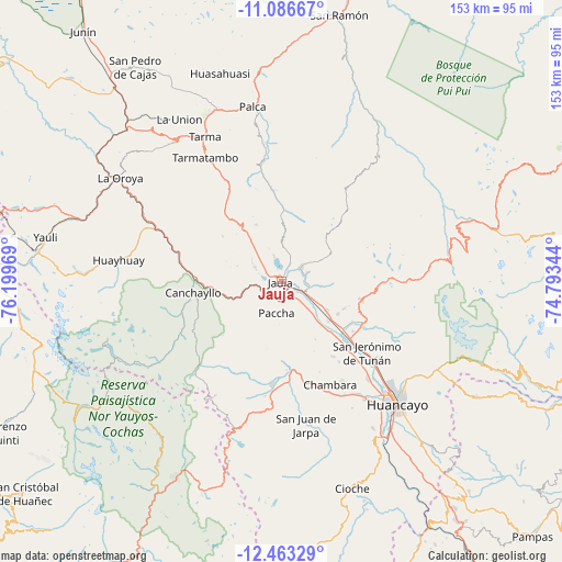
Jauja GPS coordinates[2]
11° 46' 33.024" South, 75° 29' 47.616" West
| Map corner | latitude | longitude |
|---|---|---|
| Upper-left | -11.08667°, | -76.19969° |
| Center: | -11.77584°, | -75.49656° |
| Lower-right: | -12.46329°, | -74.79344° |
| Map W x H: | 153.1×153.1 km | = 95.1×95.1mi |
| max Lat: | -0.96667° ⇑49.9% North |
| Jauja: | -11.77584° |
| min Lat: | ⇓50.1% South -18.01465° |
| min Long | Jauja | max Long |
| -81.30472° | -75.49656° | -69.04167° |
| W 52.5%⇐ | ⇒47.5% E |
Elevation
Elevation of Jauja is 3380 m = 11089 ft, and this is 1061.3 m = 3482 ft above average elevation for this country.
| Max E: |
5022 m = 16476 ft | 28.3% |
| Jauja | 3380 m 11089 ft | |
| Avg. | 2318.7 m = 7607 ft | |
Min E: |
1 m = 3 ft | 71.7% |
See also: Peru elevation on elevation.city.
Geographical zone
Jauja is located in South Torrid zone (between Equator and Tropic of Capricorn). Distance of this Southern Tropic circle is 1296.6 km =805.7 mi to South.| Distance of | km | miles | from Jauja |
|---|---|---|---|
| Equator | 1309.4 | 813.6 | to North |
| Tropic Capricorn | 1296.6 | 805.7 | to South |
| Antarctic Circle | 6091.8 | 3785.3 | to South |
| South Pole | 8697.7 | 5404.5 | to South |


Nearby cities:
15 places around Jauja: (largest is in red/bold)
• Acolla
7.3 km =4.5 mi,  312°
312°
• Ataura
6.8 km =4.2 mi,  114°
114°
• Huamali
8.6 km =5.3 mi, 113°
• Huaripampa
4.5 km =2.8 mi,  142°
142°
• Huertas
2.6 km =1.6 mi,  70°
70°
• Julcan
6.8 km =4.2 mi,  75°
75°
• Marco
8.2 km =5.1 mi,  298°
298°
• Masma
7.8 km =4.8 mi,  97°
97°
• Molinos
7.2 km =4.5 mi,  52°
52°
• Muquiyauyo
6.2 km =3.9 mi,  132°
132°
• Paca
7 km =4.3 mi,  342°
342°
• Pancan
3.2 km =2 mi,  20°
20°
• Parco
6 km =3.7 mi,  243°
243°
• Sausa
2.4 km =1.5 mi, 144°
• Yauli
7.3 km =4.5 mi, 19°
Sources, notices
• [Note1] Compared only with cities in Peru existing in our database
• [Src1] Map data: © OpenStreetMap contributors (CC-BY-SA)
• [Src2] Other city data from geonames.org with taken over terms of usage.
• [Src3] Geographical zone / Annual Mean Temperature by Robert A. Rohde @ Wikipedia
