Tumbagaan geodata
Tumbagaan (Autonomous Region in Muslim Mindanao) is a populated place; located in Philippines in Asia/Manila (GMT+8) time zone. With population of 2,261 people, there are 3763 cities with bigger population in this country. Compared to other cities in Philippines, 99.5% of cities are located further ↑North; 95.3% of cities are located further →East and 100% of cities have higher elevation than Tumbagaan. Note1
Administrative division(s):
- Level 1: Autonomous Region in Muslim Mindanao
- Level 2: Province of Tawi-Tawi
- Level 3: Languyan


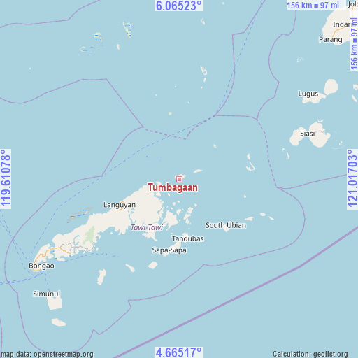
Tumbagaan GPS coordinates[2]
5° 21' 56.16" North, 120° 18' 50.04" East
| Map corner | latitude | longitude |
|---|---|---|
| Upper-left | 6.06523°, | 119.61078° |
| Center: | 5.3656°, | 120.3139° |
| Lower-right: | 4.66517°, | 121.01703° |
| Map W x H: | 155.7×155.7 km | = 96.7×96.7mi |
| max Lat: | 20.78733° ⇑99.5% North |
| Tumbagaan: | 5.3656° |
| min Lat: | ⇓0.5% South 4.65442° |
| min Long | Tumbagaan | max Long |
| 117.04868° | 120.3139° | 126.58417° |
| W 4.7%⇐ | ⇒95.3% E |
Elevation
Elevation of Tumbagaan is 0 m = 0 ft, and this is 87.9 m = 288 ft below average elevation for this country.
| Max E: |
2262 m = 7421 ft | 100% |
| Avg. | 87.9 m = 288 ft | |
| Tumbagaan | 0 m = 0 ft | |
Min E: |
-2 m = -7 ft | 0% |
See also: Philippines elevation on elevation.city.
Geographical zone
Tumbagaan is located in North Torrid zone (between Equator and Tropic of Cancer). Distance of Equator is 596.6 km =370.7 mi to South.| Distance of | km | miles | from Tumbagaan |
|---|---|---|---|
| North Pole | 9410.5 | 5847.4 | to North |
| Arctic Circle | 6804.6 | 4228.2 | to North |
| Tropic Cancer | 2009.3 | 1248.5 | to North |
| Equator | 596.6 | 370.7 | to South |


Nearby cities:
15 places around Tumbagaan: (largest is in red/bold)
• Balimbing
49.8 km =30.9 mi,  230°
230°
• Bankaw
51.2 km =31.8 mi,  221°
221°
• Buan
37.7 km =23.4 mi, 232°
• Kolape
56.7 km =35.2 mi, 234°
• Kungtad
62.8 km =39 mi,  70°
70°
• Languyan
28.3 km =17.6 mi,  245°
245°
• Lookan
43.4 km =27 mi,  212°
212°
• Manubul
55 km =34.2 mi,  77°
77°
• New Batu Batu
58.1 km =36.1 mi,  235°
235°
• Parangan
52.1 km =32.4 mi, 233°
• Parian Dakula
55 km =34.2 mi, 67°
• Sapa
23.5 km =14.6 mi,  177°
177°
• Siasi
58.9 km =36.6 mi, 70°
• Tongouson
43.2 km =26.8 mi, 207°
• Ungus-Ungus
63.1 km =39.2 mi, 236°
Sources, notices
• [Note1] Compared only with cities in Philippines existing in our database
• [Src1] Map data: © OpenStreetMap contributors (CC-BY-SA)
• [Src2] Other city data from geonames.org with taken over terms of usage.
• [Src3] Geographical zone / Annual Mean Temperature by Robert A. Rohde @ Wikipedia
