Tiring geodata
Tiring (Western Visayas) is a populated place; located in Philippines in Asia/Manila (GMT+8) time zone. With population of 2,232 people, there are 3818 cities with bigger population in this country. Compared to other cities in Philippines, 58.7% of cities are located further ↑North; 54.7% of cities are located further →East and 67.1% of cities have lower elevation than Tiring. Note1


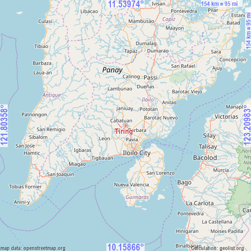
Tiring GPS coordinates[2]
10° 51' 0" North, 122° 30' 24.12" East
| Map corner | latitude | longitude |
|---|---|---|
| Upper-left | 11.53974°, | 121.80358° |
| Center: | 10.85°, | 122.5067° |
| Lower-right: | 10.15866°, | 123.20983° |
| Map W x H: | 153.6×153.6 km | = 95.4×95.4mi |
| max Lat: | 20.78733° ⇑58.7% North |
| Tiring: | 10.85° |
| min Lat: | ⇓41.3% South 4.65442° |
| min Long | Tiring | max Long |
| 117.04868° | 122.5067° | 126.58417° |
| W 45.3%⇐ | ⇒54.7% E |
Elevation
Elevation of Tiring is 46 m = 151 ft, and this is 41.9 m = 137 ft below average elevation for this country.
| Max E: |
2262 m = 7421 ft | 32.9% |
| Avg. | 87.9 m = 288 ft | |
| Tiring | 46 m = 151 ft | |
Min E: |
-2 m = -7 ft | 67.1% |
See also: Philippines elevation on elevation.city.
Geographical zone
Tiring is located in North Torrid zone (between Equator and Tropic of Cancer). Distance of Equator is 1206.4 km =749.6 mi to South.| Distance of | km | miles | from Tiring |
|---|---|---|---|
| North Pole | 8800.7 | 5468.5 | to North |
| Arctic Circle | 6194.8 | 3849.3 | to North |
| Tropic Cancer | 1399.5 | 869.6 | to North |
| Equator | 1206.4 | 749.6 | to South |


Nearby cities:
15 places around Tiring: (largest is in red/bold)
• Aganan
8 km =5 mi,  158°
158°
• Alimodian
8.8 km =5.5 mi,  248°
248°
• Balibagan Oeste
5.7 km =3.5 mi,  168°
168°
• Bolong
3.9 km =2.4 mi, 163°
• Cabatuan
4 km =2.5 mi,  325°
325°
• Cabugao
6.1 km =3.8 mi,  136°
136°
• Cadagmayan Norte
3.8 km =2.4 mi,  191°
191°
• Jibao-an
7.4 km =4.6 mi, 185°
• Kabilauan
7.4 km =4.6 mi,  80°
80°
• Maasin
9.2 km =5.7 mi,  301°
301°
• Pavia
9.2 km =5.7 mi,  152°
152°
• San Antonio
8.3 km =5.2 mi,  228°
228°
• San Jose
9.3 km =5.8 mi, 161°
• San Miguel
9 km =5.6 mi,  209°
209°
• Santa Barbara
4.3 km =2.7 mi,  134°
134°
Sources, notices
• [Note1] Compared only with cities in Philippines existing in our database
• [Src1] Map data: © OpenStreetMap contributors (CC-BY-SA)
• [Src2] Other city data from geonames.org with taken over terms of usage.
• [Src3] Geographical zone / Annual Mean Temperature by Robert A. Rohde @ Wikipedia
