Santa Maria geodata
Santa Maria (Calabarzon) is a seat of a third-order administrative division; located in Philippines in Asia/Manila (GMT+8) time zone. With population of 6,603 people, there are 949 cities with bigger population in this country. Compared to other cities in Philippines, 74% of cities are located further ↓South; 68.1% of cities are located further →East and 70.2% of cities have higher elevation than Santa Maria. Note1


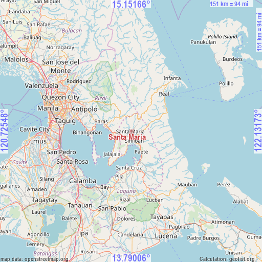
Santa Maria GPS coordinates[2]
14° 28' 18.84" North, 121° 25' 42.96" East
| Map corner | latitude | longitude |
|---|---|---|
| Upper-left | 15.15166°, | 120.72548° |
| Center: | 14.4719°, | 121.4286° |
| Lower-right: | 13.79006°, | 122.13173° |
| Map W x H: | 151.4×151.4 km | = 94.1×94.1mi |
| max Lat: | 20.78733° ⇑26% North |
| Santa Maria: | 14.4719° |
| min Lat: | ⇓74% South 4.65442° |
| min Long | Santa Maria | max Long |
| 117.04868° | 121.4286° | 126.58417° |
| W 31.9%⇐ | ⇒68.1% E |
Elevation
Elevation of Santa Maria is 12 m = 39 ft, and this is 75.9 m = 249 ft below average elevation for this country.
| Max E: |
2262 m = 7421 ft | 70.2% |
| Avg. | 87.9 m = 288 ft | |
| Santa Maria | 12 m = 39 ft | |
Min E: |
-2 m = -7 ft | 29.8% |
See also: Philippines elevation on elevation.city.
Geographical zone
Santa Maria is located in North Torrid zone (between Equator and Tropic of Cancer). Distance of this Northern Tropic circle is 996.8 km =619.4 mi to North.| Distance of | km | miles | from Santa Maria |
|---|---|---|---|
| North Pole | 8397.9 | 5218.2 | to North |
| Arctic Circle | 5792 | 3599 | to North |
| Tropic Cancer | 996.8 | 619.4 | to North |
| Equator | 1609.1 | 999.8 | to South |


Nearby cities:
15 places around Santa Maria: (largest is in red/bold)
• Bagombong
15.5 km =9.6 mi,  200°
200°
• Daraitan
14.6 km =9.1 mi,  1°
1°
• Famy
4.4 km =2.7 mi,  151°
151°
• Kabulusan
12.6 km =7.8 mi,  193°
193°
• Kapatalan
6.6 km =4.1 mi,  87°
87°
• Mabitac
5.1 km =3.2 mi,  179°
179°
• Malaya
12.8 km =8 mi,  229°
229°
• Paagahan
4.2 km =2.6 mi,  224°
224°
• Paete
13.3 km =8.3 mi, 153°
• Pakil
11.2 km =7 mi, 151°
• Pangil
8.6 km =5.3 mi, 152°
• Pililla
13.3 km =8.3 mi,  276°
276°
• Quisao
11 km =6.8 mi,  247°
247°
• Sampaloc
10.6 km =6.6 mi,  315°
315°
• Siniloan
5.9 km =3.7 mi,  161°
161°
Sources, notices
• [Note1] Compared only with cities in Philippines existing in our database
• [Src1] Map data: © OpenStreetMap contributors (CC-BY-SA)
• [Src2] Other city data from geonames.org with taken over terms of usage.
• [Src3] Geographical zone / Annual Mean Temperature by Robert A. Rohde @ Wikipedia
