Puro Pinget geodata
Puro Pinget (Ilocos) is a populated place; located in Philippines in Asia/Manila (GMT+8) time zone. With population of 4,034 people, there are 1709 cities with bigger population in this country. Compared to other cities in Philippines, 97.1% of cities are located further ↓South; 94.6% of cities are located further →East and 95.5% of cities have higher elevation than Puro Pinget. Note1


Puro Pinget GPS coordinates[2]
17° 40' 46.812" North, 120° 21' 31.788" East
| Map corner | latitude | longitude |
|---|---|---|
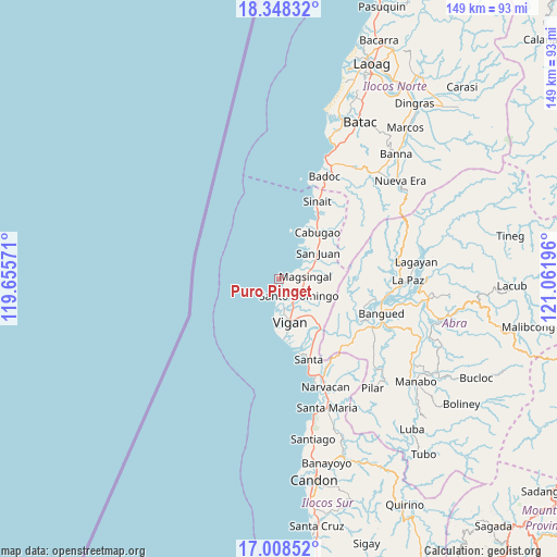
| Upper-left | 18.34832°, | 119.65571° |
| Center: | 17.67967°, | 120.35883° |
| Lower-right: | 17.00852°, | 121.06196° |
| Map W x H: | 149×149 km | = 92.6×92.6mi |
| max Lat: | 20.78733° ⇑2.9% North |
| Puro Pinget: | 17.67967° |
| min Lat: | ⇓97.1% South 4.65442° |
| min Long | Puro Pinget | max Long |
| 117.04868° | 120.35883° | 126.58417° |
| W 5.4%⇐ | ⇒94.6% E |
Elevation
Elevation of Puro Pinget is 5 m = 16 ft, and this is 82.9 m = 272 ft below average elevation for this country.
| Max E: |
2262 m = 7421 ft | 95.5% |
| Avg. | 87.9 m = 288 ft | |
| Puro Pinget | 5 m = 16 ft | |
Min E: |
-2 m = -7 ft | 4.5% |
See also: Philippines elevation on elevation.city.
Geographical zone
Puro Pinget is located in North Torrid zone (between Equator and Tropic of Cancer). Distance of this Northern Tropic circle is 640.1 km =397.7 mi to North.| Distance of | km | miles | from Puro Pinget |
|---|---|---|---|
| North Pole | 8041.3 | 4996.6 | to North |
| Arctic Circle | 5435.4 | 3377.4 | to North |
| Tropic Cancer | 640.1 | 397.7 | to North |
| Equator | 1965.8 | 1221.5 | to South |


Nearby cities:
15 places around Puro Pinget: (largest is in red/bold)
• Bantay
11 km =6.8 mi,  163°
163°
• Cabittaogan
11.3 km =7 mi,  179°
179°
• Cabugao
16.4 km =10.2 mi,  39°
39°
• Caoayan
13.7 km =8.5 mi, 162°
• Fuerte
16.2 km =10.1 mi, 176°
• Mabilbila Sur
21.1 km =13.1 mi, 155°
• Magsingal
7 km =4.3 mi,  85°
85°
• Pudoc North
7.9 km =4.9 mi,  172°
172°
• San Ildefonso
7.5 km =4.7 mi,  147°
147°
• San Juan
12.6 km =7.8 mi,  56°
56°
• San Sebastian
6.3 km =3.9 mi, 175°
• San Vicente
9.3 km =5.8 mi, 170°
• Santa Catalina
9.2 km =5.7 mi, 179°
• Santo Domingo
7.4 km =4.6 mi,  131°
131°
• Vigan
12 km =7.5 mi, 165°
Sources, notices
• [Note1] Compared only with cities in Philippines existing in our database
• [Src1] Map data: © OpenStreetMap contributors (CC-BY-SA)
• [Src2] Other city data from geonames.org with taken over terms of usage.
• [Src3] Geographical zone / Annual Mean Temperature by Robert A. Rohde @ Wikipedia
